| |
CoCoRaHS: valuable precipitation data for the District
By Nolan Doesken, Colorado State Climatologist
Local residents, with precision rain gauges in their yards, are providing valuable assistance for District rainfall monitoring and flood warning activities. During 2006, over 400 volunteers from 8 counties in and around the Denver metro area submitted 85,000 individual rainfall reports. The largest one-day rainfall report from this region occurred on July 3 just east of Sedalia where 3.14" fell.
CoCoRaHS; the Community Collaborative Rain, Hail and Snow Network; is a "Citizen Science" project coordinated by the Colorado Climate Center at Colorado State University (CSU). The project originated in northern Colorado as the result of the devastating flash flood that hit Fort Collins in July 1997. The storm dropped over 10" of rain in 5 hours and over 14" in just over 24 hours in parts of Fort Collins. This was the most rain ever documented within an urbanized area in Colorado. Meanwhile, just a few miles away, less than 1" of rain was reported. Since that time hundreds of volunteers have been recruited by CSU climatologists to help track and report storms.
The network of northern Colorado volunteers expanded into the Denver area in 2002. Since that time, the District has provided annual support to increase volunteer participation in CoCoRaHS and improve data quality and availability for the Denver area. Since 2002, nearly 1000 volunteers have joined the CoCoRaHS effort in the Denver area. Some participate for a few months while others have stuck with the project since the beginning. More volunteers are needed each year to maintain a high-definition rainfall observing network. In 2006, 49 new volunteers joined the CoCoRaHS team in the Denver area. Statewide, a total of 3,600 volunteers have participated since the project first started in 1998.
| County |
Max 1-day rainfall |
Date |
Location |
| Adams |
1.35" |
7/9/2006 |
Northglenn 4 NNE |
| Arapahoe |
2.25" |
8/2/2006 |
Foxfield 3 E |
| Boulder |
1.64" |
6/25/2006 |
Boulder 1 NW |
| Broomfield |
1.08" |
8/14/2006 |
Superior 3 E |
| Denver |
1.97" |
8/20/2006 |
Denver 3 NW |
| Douglas |
3.14" |
7/4/2006 |
Sedalia 2 E |
| Jefferson |
1.70" |
8/4/2006 |
Ralston Buttes |
| |
|
|
|
| Nearby Counties: |
|
|
|
| Clear Creek |
1.77" |
8/20/2006 |
Idaho Springs 2 WSW |
| Elbert |
1.85" |
8/27/2006 |
Elizabeth 10 NNE |
| Gilpin |
1.37" |
7/9/2006 |
Rollinsville |
Summary of 2006 precipitation
This year got off to a dry start with much below average precipitation over much of Colorado during April, May and June. But as July began, weather patterns changed and several significant storms were reported, particularly over the southern and eastern portions of the Denver metro area. The fall was cool with a few storms. One of the larger precipitation events of the year occurred on October 26th with several inches of very wet snow over the entire metro area.
Rainfall Extremes for 2006
As is almost always the case, heavy rains were spotty and localized during 2006. Compared to some years, large events were relatively infrequent and not excessive. Still there were several very significant heavy rain events.
The table above shows the greatest one-day rainfall from CoCoRaHS observers in each county in or near the District area during 2006. Precipitation totals are for the 24-hour period ending at 7AM of the date shown.
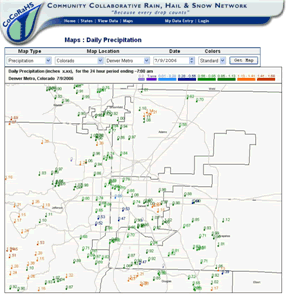
When averaged over the entire Denver metro area, the wettest day of the year (using 24-hour CoCoRaHS precipitation totals ending at 7 AM each morning) was July 9 with a regional average of nearly 1-inch. That was a gentle, soaking rain with only modest urban runoff.
More volunteers needed
More CoCoRaHS volunteers are still needed. Storms that produce high-intensity rainfall are often quite localized, and an ideal network would consist of at least one rain gauge per square mile over the entire Denver metro area and tributary watersheds. If you would like to help track our fascinating and highly variable storms, visit the CoCoRaHS website at www.cocorahs.org and click the "Join CoCoRaHS" button. Volunteer coordinators throughout the Denver area are ready to help get you set up!
|
|