Category Archives: FRAUG & F2P2 Emails

Sent to the Front Range ALERT Users Group (FRAUG) & F2P2 Partners via MHFD’s email subscription service

The 2020 Flood Season

To: All F2P2 Partners

In compiling our notes for this year, we wanted to give everyone a chance to weigh-in on any flooding events that may have impacted your communities or you personally.  As most of you already know, 2020 had very few rainstorms capable of causing serious flood impacts making this year our least impactful since the F2P2 began 42 years ago.

To help with your recall, here are the storm dates that likely produced daily rainfall amounts of 2” or more:

DATELOCATION(s) POTENTIALLY IMPACTEDNOTES*
May 24General widespread, low intensity rainfallmax GARR  >3.29”, no rain alarms
June 26Arapaho, Boulder, Denver, Douglas & Jefferson Counties including Aurora and Lakewoodmax GARR  >2.97”, greatest number of rain alarms for a single day in 2020
July 4Aurora & southern Douglas Countymax GARR  >3.41”
July 9Adams County (Barr Lake area northwest of DIA)max GARR >2”, no rain alarms
July 19extreme SE Aurora & Arapahoe Countymax GARR  >1.96”
*For more details and other storm days see https://f2p2.udfcd.org/2020_summary.html

Intense rainfall exceeding 3 inch-per-hour rates occurred on other days , but total rainfall for those days was under 2 inches. For 2020 rainfall intensity/duration/frequency measurements, download the PeakRain Excel workbook.

Any information you can send us will be most appreciated. Thank you for all you do to keep your communities safe.


Final closing climate trivia…2020 was Colorado’s 3rd driest year on record.
Kevin Stewart, P.E.
Engineering Services Manager
MILE HIGH FLOOD DISTRICT
2480 W. 26th Ave Suite 156-B | Denver, Colorado 80211
Office: 303-455-6277 | Direct: 303-749-5417 | www.mhfd.org

Protecting People, Property, and our Environment


New ArcGIS Map

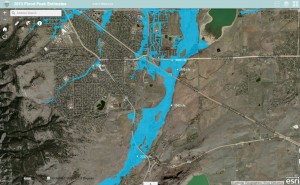
We recently improved one of our Esri ArcGIS Online maps that you may find useful.  The new map shows flood hazard areas, September 2013 flood peaks and hydrography for major drainageways within UDFCD.  Stream names can be displayed by clicking on the streams.  A link can be found on our ALERT System website from the Maps menu.

arcgisonline20150325

ALERT Map & Server Changes

ahps legend1A number of changes have been made this past month to improve the performance of the ALERT Map and timeliness of the XML files that are used by other real-time applications.

  1. A second NovaStar-5 server is now fully operational. This backup server mirrors the primary server database at Diamond Hill, is remotely located, and will failover automatically should the primary server become disabled. The backup unit also permits load sharing of data processing task. This means that XML files accessible from cloud services can be updated more frequently.  Currently all rainfall, water level and weather data files are updated every minute.
  2. The ALERT Map is one application that benefits from the dual-server implementation. Users should note more reliable automatic 1-minute data refresh rates.
  3. Other changes to the ALERT Map include:
    • NWS warning area polygons are turned on by default and provide one-click access to the corresponding NWS warning product. Just click on the icon attached to the polygon to read the NWS warning.
    • WDT looped Radar images are turned on by default reflecting the last hour of activity. All Radar images have their opacity set for 50%, allowing users to easily see the base map. All gaging station readouts overlay on top of the Radar images.
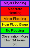
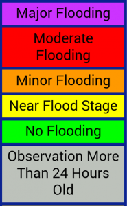
    • Color coding is applied to all ALERT stage and discharge readouts to reflect threat conditions. The colors correspond to NWS AHPS threat levels with the exception of the blue readout, which represents bankfull conditions.
    • USGS and DWR streamgage readouts are displayed on the stage and discharge maps using darker green backgrounds to distinguish their data from the ALERT data. Links to corresponding webpages supported by the USGS and Colorado DWR can be found by clicking on the readout.
    • Time series plots and links to tabular data are available for all ALERT readouts including measured water levels, discharge estimates and rainfall.

We hope you find these improvements useful. As always, your comments and suggestions are welcome.

ALERT5 Migration

We have migrated our alert5.udfcd.org URL to a new homepage.  This site contains many of the same features available on the previous ‘alert5’ website.  We believe you will find this new page much easier to use, especially those of you who have smartphones, tablets and iPads.   For those who prefer the previous website, convenient links are provided for accessing the old alert5 webpage.

Monitoring streamflow and water levels

[Fraug 5/16/2014] Monitoring streamflow and water levels

ahps legend1We recently updated a number of ALERT webpages with AHPS features.  AHPS is a NWS acronym that stands for Advanced Hydrologic Prediction Service.  See http://water.weather.gov/ahps2/index.php?wfo=bou for more information about AHPS.  The legend provided was acquired from the NWS AHPS website.  The yellow “Near Flood Stage” is also commonly referred to as the “Action Stage.”

Our AHPS-like ALERT webpages use the same AHPS reference levels.  These levels are used by NWS as guidance for issuing flood advisories and warnings. Three UDFCD webpages that currently employ this feature are:

  1. Contrail Stage Summary Table by OneRain
  2. ALERT Maps by WET
  3. ALERT Streamflow Map by LRE


September 2013 Flood Peaks

[Fraug 4/28/2014] September 2013 Peak Flow Estimates

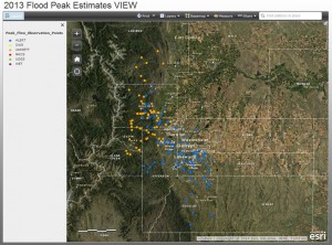
We are putting together a webmap tool to view peak flow estimates from the floods of last September.  Thought you all might be interested in this.  Your comments are always welcome.  This is a work in progress.

URL is http://udfcd.maps.arcgis.com/apps/OnePane/basicviewer/index.html?appid=326e38499aa6453bb4ccc56f7facbf6c

See also https://alert5.udfcd.org/?page_id=115 for link.

ESRI webmap tool for finding peak flow estimates from floods of September 9-15, 2013

ESRI webmap tool for finding peak flow estimates from floods of September 9-15, 2013

WDT HydroWatch Update

Inaugural FRAUG Report 4/22/2014

We made a couple of minor changes to this custom radar website:

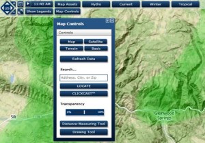
  1. The radar image default setting is now  50% transparent.  To change this  use the [Map Controls] button and slider.
    WDT Transparency
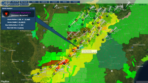
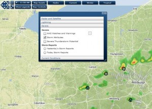
  2. The Storm Attributes default setting is now ON.  To change this use the [Current] button, select “Severe” and uncheck the Storm Attributes box. The directional pulse shows where storms are expected to move over the next hour.  If you do not see a pulse, try turning the Storm Attributes off, then on again.
    WDT Storm Attributes

The images above are current so I had to find some locations outside the District to demonstrate these features.

The website link can be found at https://alert5.udfcd.org.  We recommend that you bookmark this URL as a good starting point to get to all the webpages supported by UDFCD’s F2P2.

Let me know if you would like training concerning this site.  Please use my email address kstewart@udfcd.org.  If you have comments that you want the entire list of subscribers to read, just send a reply to this email.

This is the first official use of this new service.  There may be a few bugs to work out.