ALERT Data & More:
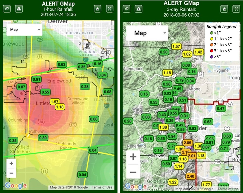 ALERT GMap is smartphone friendly, however, it’s touch features may be difficult for some users to navigate. Desktop/laptop users should find GMap easy to use. This popular map can also be quickly launched by clicking the logo on the Alert5 homepage. Zero readouts are not displayed on this map.
A “Lite” version of GMap designed for Twitter followers is another option. To check the operational status of all ALERT rain gages use the station status GMap. Green & red squares are used to show functioning & malfunctioning stations, and a red ‘x‘ indicates that a station is either out-of-service or discontinued.
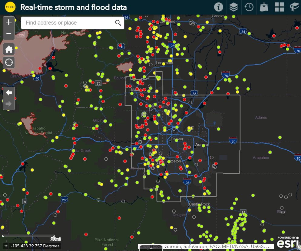
Our Contrail website is another great option for viewing ALERT data. The TriLynx NovaStar5 viewer is another choice and be sure to check out real-time storm/flood data from our latest ESRI ArcMap.
 The AHPS-like webmap is designed for monitoring stream and reservoir water levels. A Google Earth™ option is also available and the NWS AHPS webpage is another good option. AHPS is an NWS acronym the stands for “Advanced Hydrologic Prediction Service.”
Flood Hazard Inventory Tool:
 The FHIT webmap contains useful information about building structures, roadway crossings, trails and other features prone to flooding.
The September 2013 Flood:
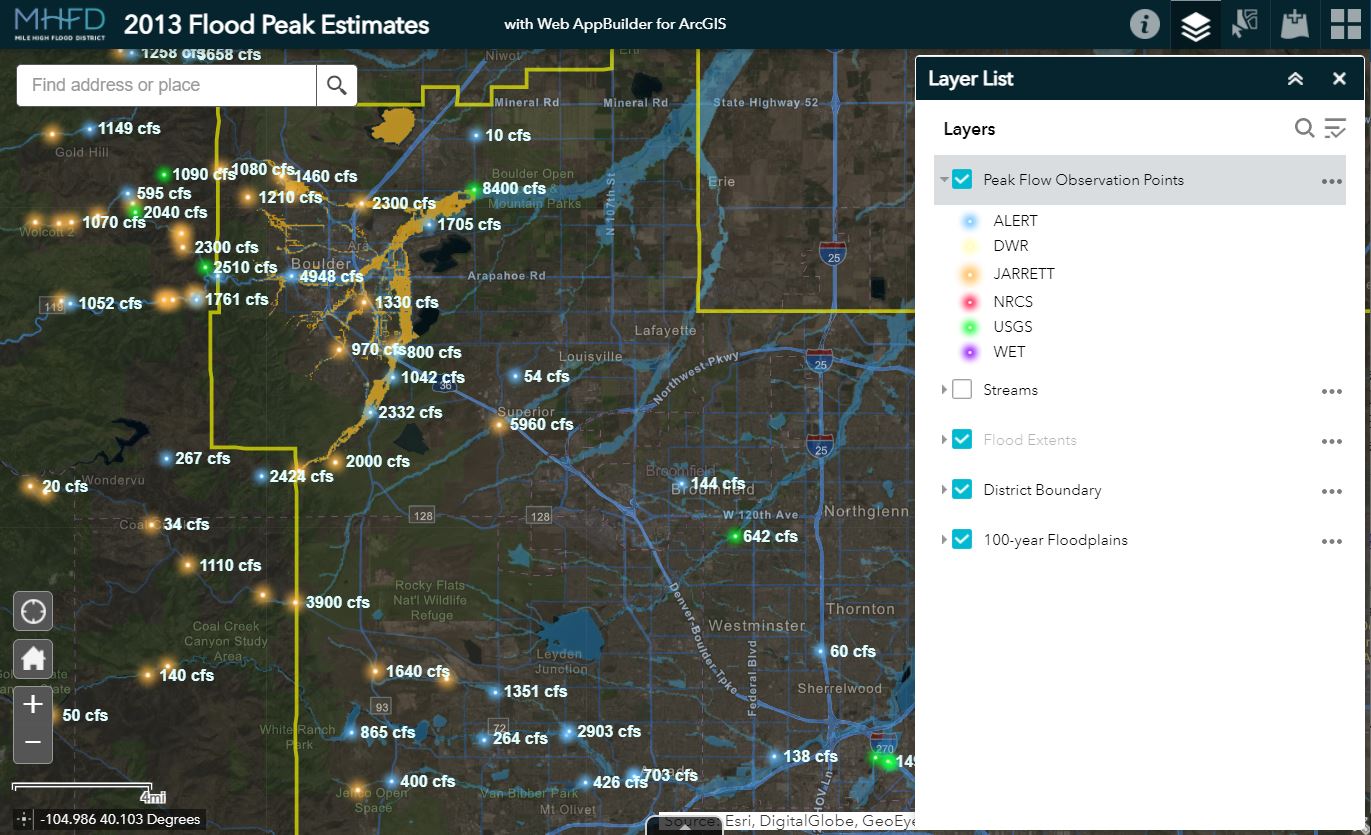 This webmap contains peak flow estimates for many locations and shows flooding extents within in the City of Boulder and for the upper portion of Westerly Creek in Aurora.
Lena Gulch Dashboards:
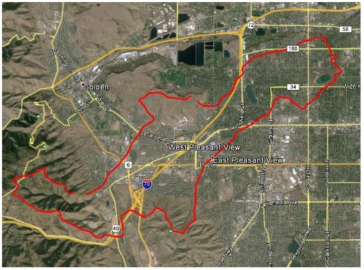 Monitor the Lena Gulch watershed in Jefferson County from a Contrail dashboard designed by OneRain that includes Gauge-Adjusted Radar Rainfall (GARR). A dashboard for Maple Grove Reservoir is also available.
Dam Safety Information:
 Dam safety information for all jurisdictional dams is available from the Colorado Division of Water Resources. MHFD has added the State’s GIS layer to our Real-time storm and flood data map for convenient reference. To view this information select the DWR Dam Safety layer using the ArcGIS layer control.
CoCoRaHS:
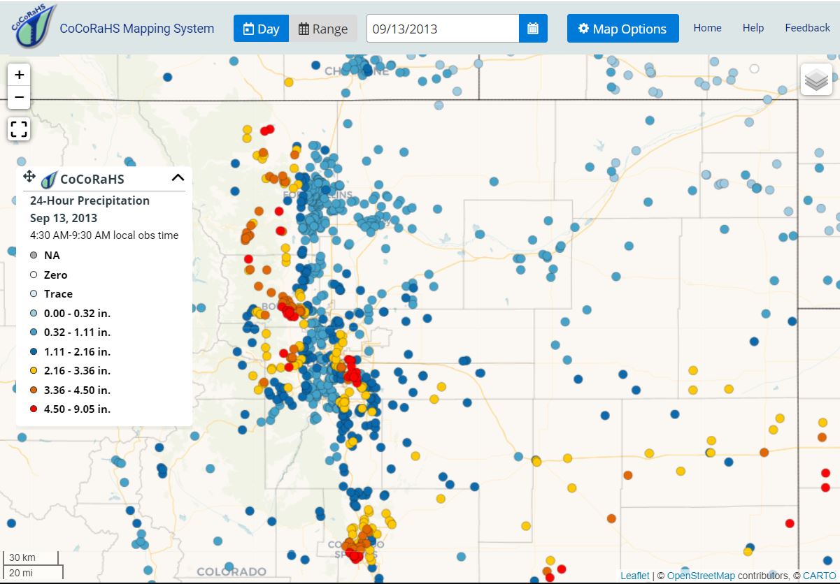
Rain, hail and snow measurements by volunteer CoCoRaHS observers. Consider joining the many who have become part of the world’s largest volunteer precipitation monitoring network.
National Weather Service:
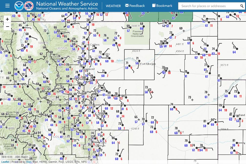 NWS Weather & Hazards Data Viewer
See also NOAA’s Point Precipitation Frequency Atlas (NOAA 14)
& the MesoWest Surface Weather Map
Colorado DWR Satellite-Monitored Streamgages:
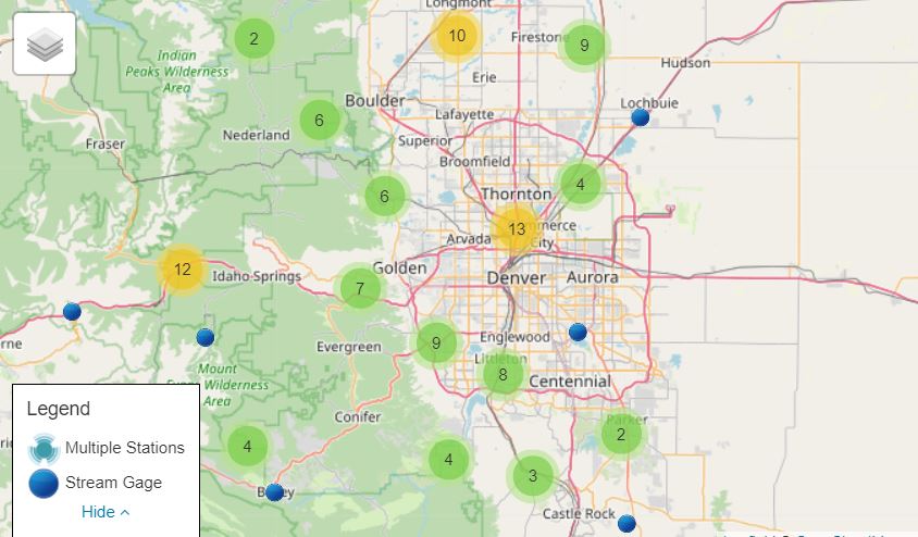
![]() Provided by the Colorado Division of Water Resources.
Provided by the Colorado Division of Water Resources.
Other Useful Tools:
 Mobile Water Data, the National Water Dashboard, WaterWatch & WaterAlert are useful websites for finding real-time streamflow information available from the U. S. Geological Survey.
![]() The National Water & Climate Center is an excellent source for precipitation, streamflow and snowpack conditions in the western U.S.
The National Water & Climate Center is an excellent source for precipitation, streamflow and snowpack conditions in the western U.S.