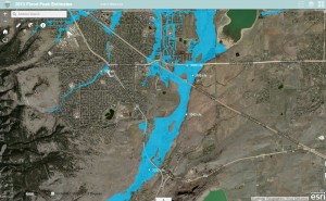
We recently improved one of our Esri ArcGIS Online maps that you may find useful. The new map shows flood hazard areas, September 2013 flood peaks and hydrography for major drainageways within UDFCD. Stream names can be displayed by clicking on the streams. A link can be found on our ALERT System website from the Maps menu.