Flood Warning Program Activities
by Kevin G. Stewart, P.E., Information Systems and Flood
Warning Program Manager
Introduction
This past year marks the 25th year of operations for the District's flash flood
prediction program (a.k.a. F2P2). Many individuals involved with the program
when it began in 1979 are still involved today. Some of the more notable
personalities include: District Executive Director Scott Tucker and our
Floodplain Management Program Chief Bill DeGroot; Eve Gruntfest, Professor of
Geography at the University of Colorado at Colorado Springs (Eve was involved
with the early research work for the District following the 1976 Big Thompson
Canyon flash flood that lead to establishing the F2P2); Larry Stern,
Boulder/Boulder County Director of Emergency Management (Larry was a Sergeant
with the Boulder County Sheriff's Department in 1979); Don Van Wie, Principal
with OneRain Incorported (Don was a Captain with the Boulder County Sheriff's
Department and his company currently maintains the District's automated flood
detection network); John Henz, Senior Principal Meteorologist with HDR
Engineering (John was the President of GRD Weather Center, which became the
first private meteorological service for the F2P2), Bob Glancy, Warning
Coordination Meteorologist with the National Weather Service in Boulder (Bob was
employed as a forecaster by GRD in 1979).
I undoubtedly have missed mentioning a few other important players, but this
list should give you some idea about the continuity of this long-running program
and the commitment level of those involved. As for me, I was first introduced to
the program in June of 1984 when I ruined my car on my way home from work by
driving into a severe thunderstorm and flood in Wheat Ridge and Arvada, which
happened just a few days after starting my new job at the District.
 |
 |
Public Information Projects
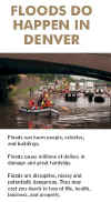
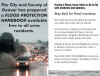
A flood protection handbook for Denver residents and businesses was completed
last May and made available free to anyone wanting a copy. It contains helpful
advice on what individuals can do before, during and after a flood to protect
their property and lives. The project was a joint effort between the Mayor's
Office of Emergency Management and the District. The handbook was publicized by
mailing 4500 English and Spanish language color brochures to Denver addresses in
or near known floodplains. Printed booklets may be obtained from the District or
Denver OEM, or by visiting the Denver Public Library. You can also download a
color version of this handbook from both the District and Denver websites. This
is the third handbook of its kind that the District has helped local governments
develop. Early versions were developed for Arvada and Boulder County.
A new project is underway to develop a flood safety information website for
Boulder, complete with video clips and other modern multimedia features. The
District and the City of Boulder funded this $30,000 initiative, which will
likely be expanded to include other Front Range communities. Marshall Freck with
the Texas Environmental Center will be conducting the work. To learn more about
this project visit the TEC website floodsafety.com.
 |
EMWIN Implementation Scheduled for 2004
Last year's issue of Flood Hazard News described plans to develop an Emergency
Managers Weather Information Network for the Denver area. EMWIN is a National
Weather Service program that allows communities to develop their own unique
applications. In addition to providing an effective low-cost way to disseminate
severe weather and flood information, it can also be used to relay civil
emergency messages, thus having the potential to supplement interagency
communications for homeland security purposes. With the District providing the
initial $15,000 in startup funds, local emergency managers secured an additional
$34,000 from a Homeland Security Grant. This money will be used to acquire EMWIN
radio equipment and software for use in emergency operation centers throughout
the region. Adams County is planning to host the satellite downlink site and
Xcel Energy is investigating their ability to host the rebroadcast station.
Skywarn Systems, Inc. of Fort Worth, Texas is providing the design and
consulting services, having developed a similar project for the Dallas/Fort
Worth area. Initial deployment and testing is expected by late Spring or early
Summer 2004.
CoCoRaHS Update
The District has been a sponsor for the Community Collaborative Rain and Hail
Study for the past two years. Nolan Doesken, Assistant State Climatologist, has
led this unique program that recently gained national prominence as the
recipient of a 3-year National Science Foundation grant totaling $897,000.
CoCoRaHS was started by the Colorado Climate Center at Colorado State University
following the July 1997 Spring Creek flash flood in Fort Collins.
Congratulations to Nolan and to the many CoCoRaHS volunteers, staff and partner
organizations. Anyone interested in measuring rain, hail and snow where you live
or work should consider becoming a CoCoRaHS volunteer. Just visit
www.cocorahs.org and join with hundreds across Colorado who enjoy participating
in this valuable climate study.
ALERT System News
The District's ALERT flood detection network continues to grow, providing
valuable early flood detection and decision support for local emergency
management and response agencies. The 165 station network includes 145 rain
gages, 80 stream gages, and 17 weather stations (wind, temperature, humidity,
pressure and other parameters). The District's ALERT webserver is highly relied
upon for accessing real-time data and sending text messages when alarm
thresholds are exceeded.
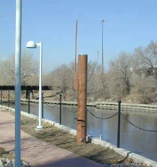
Nine new stations were added to the ALERT network in 2003. Three rain gages
were installed at Chatfield Dam, the Denver Zoo and the Roslyn Public Works
Facility in north Denver. A fourth rain gage was recently made ready for 2004
operations at Fire Station No. 12 in Aurora near I-70 and Airport Blvd. Four
combination rain/stream gages were installed on East Plum Creek near Haskins
Gulch in Douglas County, on Sulphur Gulch in Parker (the newest addition), on
Sanderson Gulch in Denver, and on the South Platte River near the Denver
Wastewater Management Division's 3rd Avenue office building.
|
Sulphur Gulch in Parker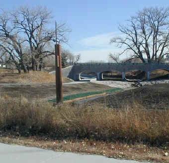 |
South Platte River at 3rd Ave in
Denver
 |
A new weather station at Aurora Reservoir is the latest addition to the ALERT
mesonet. The Urban Farm at Stapleton weather station was discontinued in June,
but plans are moving forward to relocate it to another site near the old
Stapleton Airport. A few more stations are expected for 2004 operations
including rain gages on Shop Creek in Aurora and in the storm approach zone for
Denver southwest of Marston Lake. New stream gages are anticipated for Lakewood
Gulch and Goldsmith Gulch in Denver, and Sand Creek, Murphy Creek and the
Gateway drainage area in Aurora. DIAD Incorporated (now OneRain) of Longmont
provided the 2003 ALERT maintenance services for the 12th consecutive year.
DIAD's name change occurred this past fall when they merged with NEXRAIN, Inc.
NEXRAIN is located in the Sacramento, California area where they specialize in
estimating rainfall from radar and surface measurements combined.
|
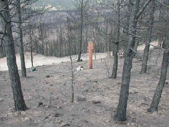
ALERT rain gage destroyed in the Boulder County Fire
|
Late season wild fires broke out in Boulder and Douglas Counties with the
2002 Hayman Fire and its recurring floods still fresh in the minds of many.
ALERT data is relied upon for fire weather support almost as much as flood
detection. The NWS forecast office in Boulder reminded us of this when they sent
the following email: "Just wanted to let you know that the ALERT mesonet
data was very valuable for our support of the wildfires on October 29. The
Button Rock, Calwood Ranch, and Sugarloaf stations were perfectly located to
cover the fire near Jamestown and were used heavily, while the Highlands Ranch
and Castle Rock stations aided our knowledge of the weather conditions in that
area. There was a lot of variability of humidity and wind in both time and space
on that day, but your network made the conditions at the fires perfectly clear.
Those of us on shift that day were very glad to have the data!"
Looking ahead, the District intends to continue improving its public
webserver capabilities by implementing more data integration and interpretation
features to further simplify the flood threat recognition process. The District
is also planning to develop a second password-protected webserver with similar
capabilities for emergency use. A new project in Boulder will soon be underway
to further improve flood threat assessments and early notifications by
incorporating GIS applications with a real-time hydrologic model for Boulder
Creek.
Meteorological Support
The District's flash flood prediction program provides forecast and notification
services directly to District local governments from April 15 through September
15 each year with this past year being our 25th year of service. HDR Engineering
Hydro-Meteorological Services of Denver provided the operational forecasts
during 2003. Bill Badini was HDR's project manager and lead meteorologist. John
Henz provided the overall training and support for HDR meteorologists. This was
the third consecutive year for HDR as the District's meteorological services
provider.
|
30 Days with Flood Potential
|
|
April
|
23
|
1
|
|
May
|
9,10,15,18,23-25,30-31
|
9
|
|
June
|
17-19,29
|
4
|
|
July
|
18-19,26-29
|
6
|
|
August
|
2-3,8-9,11,18,23-24,29-30
|
10
|
|
September
|
None
|
0
|
2003 District Floods
The 2003 flood season gave the District its usual number of trouble days, but
passed by without major disaster. Once again we consider ourselves fortunate and
wonder how long our good fortune will last given the flood history of this
region. The March 17-20 snowstorm was without question the biggest single
hydrologic event of the year with nearly 4 inches of liquid moisture falling
over much of the District and our mountain watersheds. Rivers and streams were
running high as the snow melted, but again we were fortunate that temperatures
remained relatively mild during that period. If daytime temperatures had reached
into the 70's, we would be telling a much different story about the March flood
of 2003.
An early start to our severe weather season began on April 17 with a Tornado
Warning being issued for the Denver metro area. Six days later we had our first
"message day" with Aurora receiving more than 1.5 inches of rain. A
total of 30 days had potential for flood-producing rainfall, while 24 of those
days realized their potential according to HDR's annual report. The NWS issued
flash flood warnings for District counties on 4 days (May 15, July 18, 27 and
29). Flood watches were issued for 2 other days (May 30 and July 28). Other than
the March snowstorm, the July 29 Golden flood arguably caused the most flood
damage in the District of any single event. ALERT rain gages set off alarms on
12 days (May 15; June 17 and 18; July 18, 19, 26 and 29; and August 8, 11, 18,
29 and 30). The following briefly describes some of the notable events:
An early evening storm caused considerable excitement in Boulder County
this day, with the NWS issuing its first flash flood warning of the season
that affected the District. The warning area included Boulder Creek and other
tributary streams west of Boulder. The storm system developed along a narrow
north/south line in the foothills just west of the City. One CoCoRaHS observer
reported 3.02 inches. The ALERT system generated its first rain rate alarm of
the year at the Betasso gage at 7:28 PM, where the rainfall totaled 2.56"
in just over an hour. Localized flood damage was reporting in the mountains,
but by the time the water reached Boulder the flood had attenuated to
non-threatening levels. The Boulder Creek gage at the bridge below Fourmile
Creek rose nearly 2 feet in 30 minutes with an estimated peak discharge of 500
cfs. Peak snowmelt runoff occurred 2 weeks later with the flow rate exceeding
1000 cfs. The storm's small aerial extent kept the peak flows on the major
streams relatively small with damages being limited mostly to mountain gravel
roads.
A surprise storm hit the District in the early morning hours between 2:30
and 3:00AM in the vicinity of US-36 and Sheridan Blvd. The storm caused some
localized flood damage to private properties according to news reports.
Rainfall intensities of 0.5 inches in 10 minutes occurred in Adams and Denver
Counties. Notice of the storm came first from the NWS at 3:20AM. HDR forwarded
the information to affected jurisdictions. The morning storms were minor in
terms of flood impact but the cooperation between the NWS, HDR and District
staff is noteworthy. The NWS deserves much thanks and credit for their
coordination efforts. Later in the day the storm activity returned with rain
reports of 1.5" to 2.5" in south Denver with 1" diameter hail.
Following the rains of June 17-19, summer heat and dryness set in with only
one message day occurring in a 28-day period between June 20 and July 17. The
extended dry period was broken this Friday evening when thunderstorms near the
Wyoming border sent out strong gust fronts to the south, causing a line of
intense storms to develop between Parker and western Aurora. Two inch per hour
rainfall was measured in SE Denver causing flooding along Goldsmith Gulch.
Messages were issued for Denver around 9:45PM and the NWS issued a flash flood
warning at 10:09PM. Fortunately the storms weakened and dissipated after 60 to
90 minutes, but not before enough rain fell to flood the Logan Street
underpass of I-25 (a.k.a. Lake Logan), causing T-REX to close the freeway
until 10:30AM the next morning. Goldsmith Gulch rose nearly 5 feet at the
Eastman Avenue ALERT gage and measured a peak flow of approximately 1100 cfs
at 10:30PM. Downstream at Iliff Avenue some cars in a parking lot were
flooded. This was due to debris blockage at the Iliff culvert trash rack,
which has caused problems in the past. Efforts are moving forward to remedy
this. Flood problems were not limited to Denver with Arapahoe County and
Aurora also being hit by heavy rain.
This was another flash flood warning day for the District in Douglas
County, where a storm dumped an estimated 3 to 4 inches of rain near
Roxborough Park. This rather large storm missed being measured by both the
ALERT system and CoCoRaHS observers, where highest reported amounts were 0.71
and 0.58 inches respectively. The ALERT measurement was made by the West Plum
Creek gage on Pine Cliff Road. The 3-4 inch estimate was from the NWS doppler
radar. No significant flooding was reported.
This day brought to a close a 5-day stretch of the most threatening
rainfall potential of the year. The NWS issued their final District flash
flood warning on this day when an early afternoon storm brought flooding to
the Golden area. One report received by the NWS indicated that there was 4
feet of water "over" Colorado Highway 93. After following-up on
this, it appeared that a more accurate account would have been that there was
4 feet of water across the highway, which forced the closure of one lane.
Regardless, the media covered the event very well and a considerable amount of
flood damage did occur to some homes in the area. The storm was very
localized. The Van Bibber Creek ALERT gage on SH 93 measured 1.34" with
0.91" occurring in just 15 minutes. Media reports also noted that the
flooding would have been much worse had certain drainage improvements not been
completed.
More information about the District's local flood warning program, its ALERT
system and the 2003 flood season can be found by visiting the website alert.udfcd.org.
Annual reports by HDR Engineering and OneRain Incorporated are also available.
[ Home
] [ Cover Story ] [ Tucker Talk ] [ Awards ] [ Floodplain Management ] [ Maintenance Eligibility ] [ Flood Warning ] [ Master Planning ] [ Stormwater Permits ] [ Atmospheric Dust ] [ South Platte River ] [ Protecting Trees ] [ Design and Construction ] [ Maintenance ] [ News Briefs ] [ Professional Activities ]
|