 |
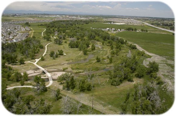
Cherry Creek Project Wins CASFM Grand Award The Cherry Creek Open Space Project, funded by Arapahoe County and UDFCD, won the Grand Award at this year's Colorado Association of State Floodplain Managers conference held in Breckenridge, Colorado. The project was managed by Paul Hindman and Lanae Raymond from Arapahoe County, currently the South East Metropolitan Storm Water Authority. Glenn Hamilton with Muller Engineering Company, Inc. designed the project and L&M Enterprises constructed the improvements. The project was initiated because of upstream development within the watershed and the sandy nature of the Cherry Creek streambed caused the channel to become incised, with down cutting of 3-5 feet on average throughout the project reach. This condition had lowered the groundwater table, and had begun to compromise the surrounding vegetation as the channel bed became progressively disconnected from its overbanks. Channel incision also resulted in steep, unstable banks in places, causing an increase in sediment load conveyance towards Cherry Creek Reservoir. In an effort to improve and protect the water quality of the Reservoir, stream stabilization projects such as this have begun to take on increasingly greater importance.
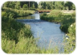
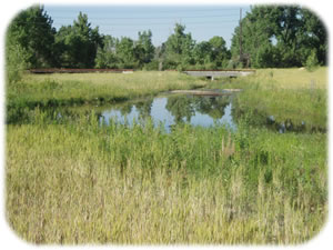
Stabilization components of the project designed to address the down-cutting channel included seven riffle drop structures, a 3-foot high vertical tie-in drop, a 2.2-foot high sloping riffle rundown at the secondary channel confluence, and two sheet pile cutoff walls integrated into pedestrian creek crossings at the two ends of the project. Restoration of the project area's ecology and vegetation were addressed by raising the channel bed and associated groundwater table back up to it's pre-incised condition, and by more frequent conveyance of Cherry Creek flows into a newly contoured secondary channel along the inside of the bend. Other components of the project further enhanced the area by providing educational and recreational amenities that capitalized on the historic context of the region. Cherry Creek Project Enhancements
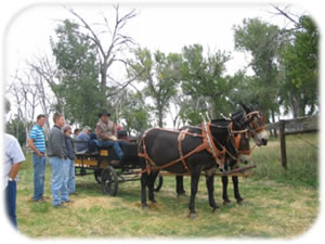
The 17-Mile House & Barn retained their historical and architectural history, appearing much as they did during the late 1800’s when they provided travelers a resting place. The rich historical context of the property was key during the design process, focusing the project team on coming up with a context-sensitive design for the Cherry Creek floodplain at this location. This project became the “public’s”, not only because the team was committed to making sure it was a community amenity, but also because of its connection to the historic site that the community had embraced as a valuable remnant of the past. The goal was to restore the natural setting to match the context of the historic mile house and barn. As shown in the following pictures, this was achieved.
|