FLOOD
HAZARD NEWS
Vol. 25, No. 1 December, 1995
![]()
The Lower Central South Platte River Through Denver
Introduction
The 10.5 mile reach of the South Platte River through Denver extends from the south City limits near the Bi-City Treatment Plant to the Burlington Ditch near the north City boundary. Included in this reach are:
| 19 parks adjacent to the river. | |
| More than 12 miles of recreational trail immediately adjacent to the river and connecting to another 6 trails with an additional 50 miles of trails. | |
| A wastewater treatment plant and a decommissioned wastewater treatment plant. | |
| Two power plants. | |
| 10.5 miles of riparian habitat. | |
| 10.5 miles of river habitat transitioning from the cold water habitat of the foothills to the warm water habitat of a prairie river. |
Surrounding this reach is a metropolitan area with more than 2 million people who demand numerous goods and services dependent on the South Platte River and its corridor including:
| Flood hazard mitigation | |
| Municipal and industrial water supply | |
| Recreation | |
| Wildlife habitat |
Multiple-Purpose Planning Required
In order to meet these goals and successfully carry out the numerous action items, the Urban Drainage and Flood Control District cooperated with the City and County of Denver to conduct multiple-purpose water resource planning. Providing flood hazard mitigation and reclaiming Denver's Central South Platte River requires responding to the many needs and demands while insuring that existing stakeholders including communities, industries, a power company, recreational users, fish and wildlife agencies, environmental regulatory agencies and existing residents are kept whole in the process.
At the same time, constraints and limitations exist that restrict the reclaiming
process including limited funding, conflicts among goals, institutional conflicts, and a
finite South Platte River water supply. To facilitate this process, multiple-purpose water
resources planning has been employed by Denver and the District in order to produce a
series of feasible projects, programs and policies acceptable to the many stakeholders and
for which necessary funding can be obtained for construction and implementation.
Project Implementation
The recently completed $7.5 million project at Confluence Park demonstrates a successful flood hazard mitigation project which also provides important opportunities for boating and recreational access to the river together with the addition of 5 acres of wetlands, reconstruction of a 24 cfs diversion structure for year around power plant cooling water, and wildlife and aquatic habitat.
The on-going Upper Central South Platte Valley at Zuni design project expands the purposes further to include expansion and improvement to the riparian and wildlife habitat, recovery of the South Platte fishery in the reach, providing recreational access to the river, provision of a safe boating drop structure, and diversion of cooling water for another power plant, along with meeting all flood control objectives.
These projects demonstrate that urban flood hazard mitigation projects can produce
significant benefits for a wide range of urban stakeholders and downstream reaches as
well.
Confluence Park to I-25 Project
The multiple-purpose project in this reach consists of:
| Removing the old diversion dam, intake and boat chute. | |
| Constructing a new diversion dam with a crest approximately 3 feet lower which is also expected to improve aquatic habitat downstream. | |
| Constructing a new and more efficient power plant cooling water diversion structure. | |
| Widening the boat chute and improving the drops for an improved boating experience and adding fish passage. |
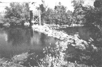
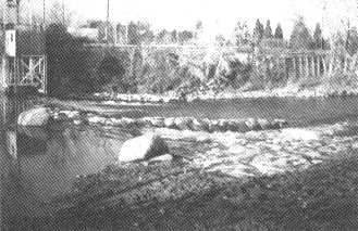
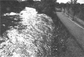
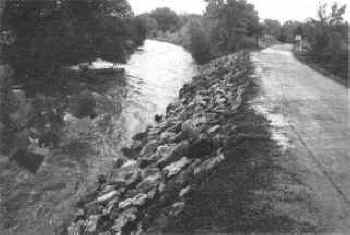
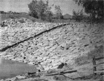
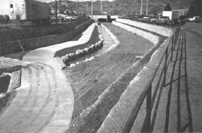
The accompanying photographs present two views of the Confluence Park diversion dam, boat and fish passage chute, trail and plaza complex. Due to the complex hydraulics, a physical model study was completed to determine hydraulics through the area while providing a starting water surface for the analysis of the flood profile for an enlarged channel between Speer Boulevard and I-25 adjacent to the new Elitch Gardens amusement park. Other additions included widening of an existing pedestrian bridge, new ADA approved ramps on both sides, an east side plaza and access to the river, connections to the new trail/maintenance road and landscaping using primarily native species. The channel in the reach upstream of Speer Boulevard to I-25 was lowered an average of 3 feet and the east bank widened approximately 100 feet. The toes of the slopes were lined with riprap to prevent the typical scour and bank sloughing previously experienced.
![]()
Two Views of Confluence Park
 |
 |
| Left: Looking directly upstream, the existing plaza is in the lower right with the new diversion dam center right and the new boat chute and plaza center left. | |
| Right: Looking down on the park the new diversion dam is on the lower right, the new boat chute and plaza goes from lower left to upper right, and the widened pedestrian bridge is across the top of the picture. |
![]()
A maintenance road/trail was added to the east bank and landscaping was added using different zones. The area at the water edge was planted with 10,000 live staked willows and the riparian zone immediately up the bank with a water table located approximately 2 feet below the surface was planted with wetland-type plants such as arctic willows. The steeper slopes of the east bank were planted with a variety of native trees and shrubs including choke cherry and rabbit brush. Approximately 300 trees and over 3,500 shrubs were planted along the east bank and Confluence Park.
Trees included primarily native species hackberry, hawthorn, juniper, cottonwood and choke cherry. Shrubs included rabbitbrush, dogwood, juniper, western sandcherry, coyote willow and dwarf arctic willow. The Colorado Division of Wildlife's list of trees and plants was used to select plantings.
The 1995 spring storms affected the project by depositing silt behind the dam and
creating sandbars in the channel. Due to the wet spring and late snows during 1995, the
South Platte River sustained flow for April, May and June varied between 2,000 and 4,000
cfs; the more typical monthly flow for the Platte in this reach is approximately 200 cfs.
Four hydrograph peaks near the 10-year flow event (approximately 9,000 cfs) occurred in
the April to June period. These 1995 spring flows provided a good test of the structural
integrity of this multiple-purpose project.
South Platte River Zuni Reach Project
The Zuni reach has a diversion dam just downstream of Thirteenth Avenue to provide
cooling water for the Public Service Company's Zuni Power Plant. The existing diversion
depends on a rubberized inflatable dam. The dam height fluctuates depending upon the
amount of flow in the river. There is presently no boat chute for this obstruction and
boaters must now portage around the dam. Due to constrictions of the Thirteenth and
Fourteenth Avenue bridges and low banks upstream, there is widespread flooding in this
reach. The current plan is to increase flood conveyance capacity of the channel by
reshaping the channel from I-25 to Eighth Avenue and eliminating the existing inflatable
dam. Implementation will include improvements to the river's fish habitat, boating,
landscape, aesthetics and wildlife habitat.
Conclusions
Implementation of the Confluence Park to I-25 reach and the design process for the Zuni reach of the South Platte River through the Central Denver flood hazard mitigation project indicates the absolute necessity for multiple-purpose flood hazard mitigation projects in urban areas. Without designing and constructing these projects to incorporate numerous features for a wide variety of stakeholders, successful design, funding, and construction of these projects would not be possible.
![]()
1995 Professional Activities of District Staff
Scott Tucker, Executive Director
*Chaired program on Stormwater Management at National Association of Flood and Stormwater Management Agencies (NAFSMA) annual conference, in Washington, D.C. in November.
*Member of Board of Directors and Chairman of the Stormwater Management Committee of NAFSMA.
*Menber of the Stormwater Phase II Advisory Subcommittee, formed pursuant to the Federal Advisory Committee Act to assist in developing the Phase II stormwater program.
*Chairman, History and Heritage Committee, Colorado Section, American Society of Civil Engineers.
*Guest lecturer at Environmental Science Class, Metro State College in Denver.
*Chapter Delegate for Colorado Chapter of American Public Works Association.
Bill DeGroot, Chief, Floodplain Management Program
*Elevated to Fellow of the American Society of Civil Engineers.
*Appointed Chair of the FEMA Liaison Committee of the National Association of Flood and Stormwater Management Agencies (NAFSMA), and chaired a panel discussion on FEMA Issues at NAFSMA's annual meetine in Washington, D.C. in Nov.
*Panelist at the 20th Annual Hazards Research and Applications Workshop in Boulder, Colorado in July.
*Secretary of the Colorado Natural Hazards Mitigation Foundation.
*Member of the Colorado Natural Hazards Mitigation Council.
Kevin Stewart, Project Engineer, Floodplain Management Program
*National Hydrologic Warning Council (NHWC) Representative for the Southwestern Association of ALERT Systems (SAAS).
*Member of the Colorado Natural Hazards Mitigation Council's Dam Safety and Warning Subcommittee.
*Speaker at ALERT Users Group annual conference in Pacific Grove, California in May and at the SAAS conference in Tulsa, Oklahoma in October.
*Represented the NHWC at the National Weather Service/FEMA Emergency Management Forum in Arlington, Virginia in March and presided at the First National Conference of the NHWC in Baltimore, Maryland in June.
*Panel discussant on "Local Emergency Management Critical Information Requirements" at the 20th Annual Hazards Research and Applications Workshop in Boulder, Colorado in July.
*Speaker on "US Approach to Flood Warnings and District's Approach to Local Flood
Warnings" at the Current Issues in Total Flood Warning System Design Workshop, Flood
Hazard Research Centre, Middlesex University, London, England in Sep.
Ben Urbonas, Chief, Master Planning & South Platte River Programs
*Organized and chaired a session on the topic of BMP Effectiveness at the ASCE Water Resources Planning and Management Division's Specialty Conference in Boston in May.
*Continues to Chair the Urban Gauging Networks Committee of the Urban Water Resources Research Council of ASCE.
*Re-elected in September to the National Board of Directors of APWA's Institute for Water Resources.
*Continued to serve as a member of the Control Group of the Urban Water Resources Research Council of ASCE.
*Moderated an APWA-IWR sponsored professional development session on Watershed Planning and GIS at the APWA Exposition and Congress in Dallas in September.
*Co-chair of the Water Environment Federation effort to publish a Stormwater Quality Management Manual of Practice. Publication is expected next summer.
*Had a paper published in the ASCE Journal of Water Resources and Planning and Management, titled "Recommended Parameters to Report With BMP Monitoring Data," February, 1995.
*Was notified by ASCE Journal of Water Resources and Planning and Management of the acceptance of a paper co-authored with Dr. C.Y. Guo titled "Maximized Detention Volume Determined by Runoff Capture Ratio" for publication in February, 1996.
*Had a paper titled "Hydrology for the Management of Stormwater Quality,"
accepted for publication in the Water Quality International Journal. Co-authors are
Larry A. Roesner, Ph.D. and James C.Y. Guo, Ph.D.
John Doerfer, Project Hydrologist, Master Planning Program
*Chairman of the Stormwater Quality Committee, Colorado Association of Stormwater and Floodplain Managers (CASFM).
*"Inventory of Structural BMPs in Urban Areas of Colorado," presented at 1995 CASFM conference in Colorado Springs in Nov.
*Guest Speaker at CASFM workshop, "Construction Erosion BMPs - A Management
Perspective." in Greeley in Nov.
Mark Hunter, Chief, Maintenance Program
*Member of International Erosion Control Association (IECA) standards committee on riprap, standards committee on articulating blocks, and the by-laws committee.
*Secretary of the Steering Committee for the IECA-Mountain States Chapter.
*Panel member for the review and evaluation of proposed testing protocol for
articulated concrete block, a Colorado State University project for the U.S. Army Corps of
Engineers.
Paul Hindman, Project Engineer, Design and Construction Program
*Vice-Chairman of the Institute of Water Resources of the Colorado Chapter of APWA.
*Treasurer of the Colorado Chapter of APWA.
![]()
Tucker-Talk 
The Urban Drainage and Flood Control District was established in 1969 by the Colorado State Legislature and in 1994 the organization celebrated its 25th year of service in the Denver metropolitan area. In the 1994 issue of Flood Hazard News I talked about the first 25 years of the Urban Drainage and Flood Control District and touched on where things might be headed in the future.
Times have certainly changed since 1969. In the early days flood control was the primary problem and typically was considered a single-purpose issue. The Urban Drainage and Flood Control District, however, since the beginning has had the vision of using drainageways as open green corridors to the maximum extent possible. Most of our projects have public access and multiple uses of the drainage corridors are encouraged. A big change since 1969 is the increased emphasis on, and interest in environmentally sensitive issues and the view of flood control as only one part of a multiple-use, multiple-faceted problem, or in some cases, opportunity. The increasing environmental sensitivity of the public will likely continue and one result will be a shift in interest to "naturalization" of urban stream corridors wherever possible. There will be a tendency to de-emphasize structural projects, and stabilization of natural streams will become an even more important activity as time goes on.
The public also has an interest in improving the quality of our water systems including small streams and gulches, rivers, lakes, estuaries, and oceans. Since 1972, when the Federal Water Pollution Control Act was first passed, the focus has been on addressing point sources of pollution from both municipal treatment facilities and industrial facilities. This has been a heavily federally subsidized program with early efforts being funded by as much as 90% by the federal government. Recently this has changed to a revolving fund concept and there is more funding at the local level. This effort has been successful in reducing pollution from point sources and the improvement in our receiving waters has been significant.
However, as the "point" sources are being controlled, more attention is shifting to the "non-point" sources of pollution. Non-point sources of pollution are generally a wet weather phenomenon and come from many sources including agriculture, silvaculture, the air, mining, urban areas, etc., and are much more difficult to address. It was relatively easy to identify where the sewage needed to be treated and, when 75 to 90% of the funding was provided by the state and federal governments, there was a limited financial impact on local governmental entities. Non-point source pollution on the other hand is much more difficult to identify in terms of where it is coming from and the impact it is having on receiving waters. It is also much more difficult to control because it comes from many small sources such as individual farms, homes, industries, commercial establishments, highways, mines, etc., etc.
Runoff in urban areas is one of the non-point sources of pollution that is being looked at closely. According to present law and regulations, storm sewer discharges in cities over 100,000 population and from most large industrial sites, defined as Phase 1 stormwater sources, are considered to be point sources of pollution. As such these cities and industries have been required to submit applications for NPDES (National Pollution Discharge Elimination System) permits. Many cities have been issued NPDES permits for their stormwater systems and others are still waiting for permits to be issued. The parameters of the permit program are defined by EPA and administered in most states by the state permitting agency; and by EPA in about ten states that are non-delegated states. It is a command and control system and local governments are being forced to react to the federal mandate. This has created an adversarial relationship and has inhibited the development of federal, state and local partnerships.
Also at this time, EPA is considering how to address the remaining municipal and industrial and commercial stormwater discharges. These stormwater discharges have been defined as Phase 2 discharges. Pursuant to the Federal Advisory Committee Act (FACA) EPA has established a committee to advise them on how to address the Phase 2 discharges. The Phase 2 FACA committee is comprised of approximately 35 individuals representing many different interest groups including industry, environmental, state, federal, Indian tribes and local governments. The charge to the committee is to reach a consensus recommendation regarding how EPA should address the task of reducing pollutants in Phase 2 stormwater discharges.
The problem with the approach to addressing Phase 1 and Phase 2 sources of stormwater pollution, in my view, is that it has not been approached as a federal-state-local partnership. The direction has been defined at the federal level and local governments have been required to seek permits under the threat of fines and penalties. This has created an adversarial relationship and has inhibited the development of real partnerships in addressing stormwater quality issues.
It cannot be denied that urbanization has significant impacts on the environment. What was once a natural prairie with tall grasses, trees, running streams and so on totally changes character when it becomes an urban area with buildings, streets, people, houses, cars, etc. Since the industrial revolution society has been moving from rural areas to urban centers. This is a movement that is beyond our control and must be recognized and dealt with realistically. People are free to move about. There is no effective way to prohibit people from moving into a metropolitan area. Therefore, urbanization is likely to continue.
However, this is not to say that we must forsake or abandon our environmental interest and concerns. While it may be unrealistic to preserve a stream or river in a pre-development condition, we can manage and protect our water resources to be high quality assets for our urban areas. The public is interested in the water resource and highly values lakes and streams of a quality that does not prohibit their use of them. The public is also interested in creating and preserving wetlands, controlling erosion, and in reducing the pollutants that enter their receiving waters. I must also add that the public is still very interested in flood protection. When lives are lost and property is damaged due to flooding, that problem becomes the number one priority. Fortunately good flood management and water quality management are not mutually exclusive.
Since the water pollution control act was passed in 1972 the basic approach has been through a command and control permitting system. This permitting system was designed and intended for point sources of pollution from sources such as municipal treatment plants and industrial treatment facilities. As the emphasis in the nation shifts from the classic point sources to non-point sources, and I include municipal stormwater as a non-point source, we are finding that the classic NPDES command and control permit system does not work so well. EPA has tried to make the NPDES system work for large cites over 100,000, but they are facing a difficult task because the permitting system was not designed to be applied to such diffuse sources of discharge. EPA and the states are now faced with demanding permits of general purpose governments and dictating to them how they should manage their stormwater systems. This has created an us-versus-them mentality and has inhibited the development of productive federal�state�local partnerships. Since we are all representing the same constituency, the people, logic would dictate or indicate that we turn away from the top down command and control approach now employed to one of true partnership and cooperation.
Now might be the time we start thinking about a different approach to non-point sources of pollution, a new paradigm if you will. I think all would agree that the municipal stormwater program will be implemented by local governments. That is where the buck stops. Local governments exist because people live in urban areas and certain basic functions need to be provided, such as police, fire protection, libraries, roads and streets, parks, and good water quality. Local governments and their citizens want and need these basic services, and they are the ones that pay for them. Now is the time for local governments to step forward and take the initiative to develop good stormwater management practices that will presumably lead to improved water quality. Federal and state agencies need to work with local governments in defining what water quality problems are caused by urban stormwater runoff and what steps can be taken to mitigate those problems. Local governments need to be a part of the problem definition if they are expected to bear the primary burden in solving the water quality problems. While we can't change the fact that urbanization will dramatically change the environment which includes streams, creeks and lakes, we can manage that change so that the receiving waters that are impacted by urbanization maintain an intrinsic value to the community that is founded on good water quality. This means that local governments must practice good erosion control, good housekeeping, must educate their citizens as to the value of their natural resources, and must maintain their water resource facilities.
There is also the matter of finite resources. Local governments only have a certain amount of money to deal with. They cannot solve every problem. Stormwater control might be a number four concern in one community and a number 20 concern in another community. Communities must be given the flexibility to address those problems they consider to be the most important.
In conclusion I hope that a new partnership consisting of local, state and federal
levels of government can be formed to work together to address water quality problems.
This partnership must be based on all the partners being at the table on an equal basis,
and being included in the process from the very beginning.
District Wins Accounting Award Again
For the seventh year in a row the District has received a "Certificate of Achievement for Excellence in Financial Reporting" from the Government Finance Officers Association of the United States and Canada. The certificate is presented to government units whose comprehensive annual financial reports achieve the highest standards in government accounting and financial reporting. Congratulations to Frank Dobbins, Chief of Finance and Accounting, for continuing this string of awards.
![]()
South Platte River Program Notes
by Bryan W. Kohlenberg, P.E., Project Engineer and Ben
Urbonas, P.E., Chief South Platte River Program
Maintenance Activities
In 1995 the South Platte River routine maintenance work included an equivalent of 47 miles of trail edge mowing, tree trimming and pruning along 7 miles of the river, and 122 miles of trash and debris pickup and removal. Over 35 truckloads of trash and debris were removed and taken to a landfill. These quantities do not include the trash picked up by the local government personnel nor the trash removed from trash receptacles maintained by park personnel along recreational trails. Although this type of routine maintenance often is not noticed or recognized by the public, without it the South Platte River corridor would have an entirely different "look." It is this type of maintenance that provides the public with a more pleasant experience whenever visiting the many trail and pocket park facilities that now exist along the 41 miles of this river between Chatfield Reservoir and the Weld/Adams County line.
The restoration maintenance program continued to provide repair of erosion damage along the maintenance trail; repairs to the trail and to maintenance access bridges; cutting and removal of a large number of dead elm trees along 10.5 miles of river bank (victims of the Dutch Elm Disease epidemic in 1992�93), restoration of a water diversion/grade control structure at Public Service Company's (PSCo) Arapahoe Plant; and stabilization, restoration, and revegetation of approximately 1800 feet of river bank in Denver (see the article on Chevron gas station site restoration). We expect more bank repair will be needed in 1996 because of extensive bank erosion damage caused last May through August by unusually protracted high flows.
Three large restorative maintenance projects were completed this year. The restoration and stabilization of the west bank of the South Platte River through Denver's proposed Rockmont Park involved bank cleanup, riprap stabilization, revegetation and strategic placement of large boulders, the last being for wildlife habitat improvements and refuge for fish during high flows. The project also included the addition of a low lying wetland planting bench for future planting by the Denver Parks Department during its Phase I of the Rockmont Park development project scheduled for 1996.
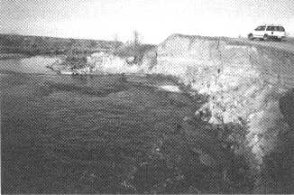
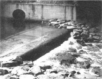
The second project was the rehabilitation of the Public Service Company's water diversion structure at the Arapahoe Power Generating Plant. The addition of a boat chute to the structure reduced the unboatable structure count on the South Platte River in Denver to one (PSCo Zuni Power Plant Dam). The chute also doubles as access for fish passage. See the two photographs that show the before-and-after views of this structure. We want to thank the Public Service Company for sharing in the cost of constructing this boat/fish passage chute and for their help during its construction.
![]()
 |
 |
Before and after views of the PSCo Arapahoe power plant diversion structure.
![]()
The third project cleaned up and restored 1200 feet of badly abused river bank in the
City of Brighton. The river bank was undermined and collapsing even though part of it was
stabilized in the past by the property owner with concrete and asphalt slabs. The overbank
was a dump of used construction materials. Brighton purchased this parcel and the District
restored and revegetated the bank and overbank. After the restoration was completed,
Brighton constructed a 10 foot wide combination recreation and maintenance trail along
this bank and planted a large number of trees and shrubs. What used to be a trashed-out
area now is a clean open space site that will mature over the coming years into another
piece of restored riparian habitat along the river.
Cooperative Projects With Private Property Owners
In exchange for flowage and maintenance access easements the District is now participating in the construction of two cooperative maintenance projects. Both involve much�needed river bank cleanup, stabilization and revegetation. One is the restoration of a degraded river bank owned by Mr. Stanley Miles in Adams County. The other is located at Cooley Gravel Company's North Dahlia Pit north of 88th Ave. in Commerce City.
In 1985 the Miles family received notification in the form of an Administrative Order from the U.S. Environmental Protection Agency (EPA) requiring them to remove unauthorized fill material consisting of refuse, wood, concrete rubble, broken asphalt and other materials, from the river bank adjacent to their property. Faced with the threat of fines of up to $25,000 per day Mr. Miles, on the advice of the EPA, contacted the District to request assistance. In exchange for a permanent flowage and maintenance access easement the District is presently removing and disposing the unauthorized fill, restoring the river bank, stabilizing it with buried riprap and revegetating the restored bank with native grasses and willows. This project poses a challenging problem in that the existing unauthorized fill material to be disposed of provides effective bank erosion protection for the Miles' family home. Also the Administrative Order requires EPA inspection of all material to be removed. Therefore, this project requires creative construction phasing and water control to minimize risk of potential property damage due to construction in a dynamic river channel and close coordination with the EPA during material removal.
The cooperative project with Cooley will restore and stabilize several hundred feet of river bank. We will also construct one river bottom degradation check structure using three to four foot diameter boulders. Cooley Gravel is providing the construction labor and equipment while the District is paying for the materials. We expect this project to be completed by the end of March, 1996.
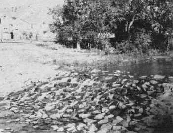
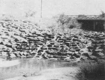
Readers of past issues of Flood Hazard News may remember the Carlson bank
stabilization project completed over two years ago. The accompanying photographs show
before and after views of the project. The vegetation effort has been successful - quite a
dramatic improvement over the pre-construction situation. We expect even more
naturalization in the future.
![]()
 |
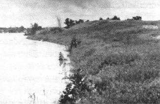 |
Carlson property before and after.
![]()
Capital Improvement Activities
During the last year the District has been cooperating with the City and County of Denver to develop and design two major river improvements projects. One is the extension upstream of the Lower Central Platte Valley Project described in the opening article of this newsletter. The design consultant has been working with the project sponsors and the PSCo to develop a way to remove PSCo's inflatable diversion dam at the Zuni Power Plant, while providing the cooling water the power plant needs to generate electricity. Three concepts were proposed and are now being evaluated by PSCo. The concept that Denver likes and which seems to offer the most river improvement potential is to convert the cooling system to a closed loop recirculating system requiring only makeup water for evaporation. Unfortunately it is also the most expensive alternative. A decision on this issue is expected early in 1996. Once made, we will authorize the consultant to complete the design for this 1200 foot reach of the river. We also hope to expand the design to the remaining 4000 feet of this reach in 1996 and begin funding construction in 1997 or 1998. Once constructed, this project will remove approximately 300 acres of central Denver from the 100-year floodplain.
The other capital project is in north Denver's Globeville neighborhood. It involves
river improvements and flood control along 7000 feet of the river. Once constructed, it
will also remove approximately 300 acres of densely urbanized area from the 100-year
floodplain. During the last year the project consultant, Love & Associates, Inc., has
prepared the final design for a 2000 foot sub-reach of this project and has also completed
a detailed preliminary design for the entire 7000 foot project area. The first phase is
expected to go to construction in 1996. In addition to flood control this project includes
terrestrial and aquatic habitat improvements, installation of 2000 feet of paved trail and
800 feet of narrow unpaved trails, and many aesthetic and environmental enhancements. The
project is located in one of the most densely industrialized areas of Denver where finding
room within a confined right-of-way for these types of enhancements is a challenge.
Nevertheless, with the input of local citizens and a large number of interested
individuals and agencies, a plan emerged. We are very excited to see it begin taking shape
in 1996.
Other News
As mentioned above, the Denver Parks Department requested District assistance with the removal of dead trees along the South Platte River. This effort has been on-going since August. At last count, over 1,000 dead trees have been cut down and chipped for use as mulch. The removal of most dead trees within the 10.5 mile reach in Denver should be completed by the end of January, after which the work will extend into Adams County to at least the Sand Creek confluence. Anyone need wood chips?
Last year the City of Littleton, South Suburban Parks and Recreation District, and the Ken Caryl Water and Sanitation District requested the District to buttress a large exposed sanitary sewer crossing just downstream of C-470. The river bottom downstream of the exposed utility crossing has degraded up to ten feet since the crossing was constructed several years ago. The design is now complete and we hope to begin construction in January, 1996. The District and Littleton are funding a rock buttress that will incorporate a fish and boat passage chute.
With District assistance the Denver Parks Department hopes to replace at least two of the remaining six timber pedestrian and maintenance access bridges crossing the South Platte River. These bridges have deteriorated badly over the last 15 to 20 years and have become a constant maintenance problem. They have apparently exceeded their expected design life. This year the District, in cooperation with Denver, retrofitted two badly worn bridge decks with recycled rubber mats commonly used on horse stall floors. This relatively low-cost fix seems to have pleased trail users and, hopefully, extended the deck life for a few more years. This, however, is a temporary reprieve and we hope to see bridge replacement begin soon.
![]()
PLANNING PROGRAM ACTIVITIES
by Ben Urbonas Chief, Master Planning Program
STATUS OF PLANNING PROJECTS
| Project | Sponsor(s) | Consultant | Status |
| Upper Box Elder Creek | Aurora, Arapahoe Co., Adams Co. | CH2MHill | Completed in 1995 |
| Columbine Basin | Arvada & Wheat Ridge | Muller Engr. Corp. | Completed in 1995 |
| Dry Gulch Update | Lakewood | Muller Engr. Corp. | Completed in 1995 |
| Stapleton Drainage | Denver | McLaughlin Water Engr. | Completed in 1995 |
| Weaver Creek Tributary | Jefferson Co. | J. F. Sato | Completed in 1995 |
| Westerly Creek U. S. of Havana | Aurora | Merrick | 90% Complete |
| Niver, Brantner & Grange Hall Cr. Updates | Thornton & Adams Co. | Kiowa | 50% Complete |
| Arapahoe & Magpie Gulches | Golden & Jefferson Co. | WRC Engineering | 50% Complete |
| Big Dry Cr. (ARAPCO) Update | Arapahoe Co., Douglas Co., Greenwood Village, Englewood, Littleton | WRC Engineering | 50% Complete |
| Willow/Little Willow Cr. | Douglas Co. | n/a | Scheduled for 1996 |
| Brighton Basin | Brighton & Adams Co. | n/a | Scheduled for 1996 |
| Cherry Creek - Reservoir to Coungy Line | Arapahoe Co. & Cherry Cr. Water Quality Authority | n/a | Scheduled for 1996 |
| East Henry's Lake Trib. to Bear Creek | Denver, Lakewood & Jefferson Co. | n/a | Scheduled for 1996 |
| City of Englewood OSP | Englewood | n/a | Scheduled for 1996 |
| Pleasantview Area OSP | Jefferson Co. & Lakewood | n/a | Scheduled for 1996 |
| Lower Box Elder Cr. OSP | Adams Co. | n/a | Scheduled for 1997 |
Planning Projects
The table titled "Status Of Planning Projects" lists the projects that were under way or completed in 1995 and the ones we hope to begin in 1996 and 1997. We will begin the consultant selection process for the 1996 projects as soon as the funding agreements are executed between the District and each project's local sponsors. This could be anywhere from the first two months of the year to late fall.
A total of five projects were completed during 1995. One of these, Outfall System Planning - Dry Gulch (Muller Engineering) replaced a master plan originally published in 1979. The original plan, although optimized for benefit/cost ratio, proved to be unaffordable and was never implemented. The new plan provides for a lesser level of flood protection, but once implemented, will eliminate a very large number of frequently occurring drainage and flooding problems in Lakewood. Affordability is something we now pay attention to when developing new plans. It is often the primary reason why some plans are never fully implemented, since local tax or other revenue often needs to be used to fund them, which revenue is not readily available and needs to compete with other municipal needs.
The Upper Box Elder Creek Outfall System Plan (CH2MHill) was completed in December and covers a 75 square mile portion of a large watershed that has its headwaters in Elbert County. This report covers the largest single area for which we have developed a plan on how to deal with stormwater quantity and quality as the watershed urbanizes.
Box Elder Creek is an ephemeral stream traversing Arapahoe and Adams Counties and City of Aurora. Outside of the small Town of Edwards in the upstream Elbert County, the entire watershed is rural in nature, with some farming and much ranching land use. The three local governments that co-sponsored this plan are concerned about what will happen to the Creek and its many tributaries as urbanization begins to occur.
From experience we know that the tributaries will experience in-stream erosion and will become unstable. Box Elder Creek itself will experience similar effects in its steeper upper reaches and stream aggradation and possible avulsion in the flatter lower reaches, all because surface runoff volumes and peaks will increase with urbanization. The plan has specific recommendations for dealing with these problems, including preservation of greenbelt corridors, and a set of facilities and a general strategy for mitigating stormwater runoff quality from new urban areas.
The Stormwater Outfall System Plan, Stapleton Area (McLaughlin Water Engineers, Ltd.) was co-sponsored by the City and County of Denver through its Stapleton 2000 Office. When the decision was made to close Stapleton Airport, Denver decided to develop a plan for the redevelopment of this seven square-mile site. The City contracted independently with the Stapleton Redevelopment Foundation to come up with the overall redevelopment plan. The District was asked to help the City to develop a stormwater management plan for the redeveloped site. Since over one half of the site did not have a creek, gulch or any other form of readily available receiving system for the increased stormwater volumes and rates, the challenge was great.
The final plan had to address not only difficult technical issues, but also had to address challenging institutional issues. In addition to the sponsors and their consultants, input was sought from a large number of local, state and federal agencies. Since the overall redevelopment plan was being done by Stapleton Redevelopment Foundation, the two had to mesh, or otherwise neither system would work. As it turned out, the major drainage outfall plan played a key role in how the overall plan was laid out. We were fortunate that drainage was recognized as a key element in the Foundation's plan and that the two efforts worked together well to make both plans work as a unit.
The final outfall system plan recommends creating new streams, detention areas, wetlands, and water quality enhancement basins. It also recommends the restoration of Westerly Creek and Sand Creek. Westerly Creek was piped 40 to 50 years ago to build new runways, while Sand Creek was narrowed down by overbank filling. Although we cannot restore these waterways to what they were before urbanization occurred, it is possible to enhance their wildlife and aquatic life character and, once restored, leave two natural greenbelts and riparian corridors for future generations to appreciate and enjoy.
The other two Outfall System Planning projects, namely, Columbine Basin (Muller
Engineering) and Bergen Reservoir Tributary to Weaver Creek (J.F. Sato and
Associates, Inc.) were much smaller in scale. However they were very important to their
sponsors: the cities of Wheat Ridge and Arvada; and Jefferson County. Both planning
efforts came up with plans to solve some of the existing drainage problems and how to deal
with new urbanizing areas that will affect already existing commercial and residential
neighborhoods. Both include recommendations that should help with stormwater quality as
well. It will now be up to the local sponsors to take the initiative to implement these
plans. The District will help and assist as needed.
Technology Transfer & Education
In our last issue I mentioned that the Colorado Department of Transportation now
requires a specialist who has received a Certified Erosion Control Training card to
be present on all of CDOT's construction projects, and that Red Rocks Community College is
offering this certification (contact Scott Olson at Red Rocks for information: telephone
988-6160, X-282). CDOT has also released its own erosion control manual titled Erosion
Control and Stormwater Quality Guide (price $15.00) and a plastic laminated Erosion
and Sediment Control Pocketbook (price $10.00). Both are excellent documents
and I encourage everyone to obtain them. Contact Philipp Sieber, Colorado Department of
Transportation, Specifications Unit, 4201 E. Arkansas Avenue, Denver, CO 80222, Tel.
303-757-9343 to order them.
Software
In the last issue I reported that Curtis Neufeld, a student intern working at the
District at that time, has modified the CUHPE/PC code to include a method that accounts
for rainfall losses when a watershed has a reduced level of directly connected impervious
area (CUHPF/PC). We asked several users of CUHPE/PC to test it and discovered some
unforeseen problems, which we think now have been corrected by Curt. We are now again
testing the software and once it checks out, it will be released as an update through Computer
Software Library, Inc. P.O. Box 27517, Denver, CO, 80227, Tel. 303-947-3413, FAX
303-985-8882, the District's software distribution agent.
Stormwater NPDES Activities
Again very little new to report on this topic. The Clean Water Act is stalled in Congress and no one can predict when it will move forward and how the Clinton Administration and Congress will finally resolve their differences.
The three largest cities in the Denver area submitted their Part 2 Permit Application to the State of Colorado in November of 1992. Since then two draft permits have been released by the State for public comment, but none of the stormwater permits have been issued as of December 1995. The three year effort to issue these permits illustrates the complexity of municipal stormwater discharge permits. The permit issuing effort does not even begin to illustrate the complexities and confusion that will probably arise after these permits are issued and have to be implemented by the municipalities, under the watchful eye of the State. Their very nature affects how, by who, and when specific urban activities will be performed. Keep in mind that the activities required by the permits will take precedence over others in these cities to not be in violation of the permit conditions.
In 1995 Arapahoe County was notified by the State that it now has an urban area population of over 100,000 and this put them into the Phase 1 category for municipal stormwater NPDES permitting. The District is assisting the County as it begins to prepare Part 1 of its application. If we think that the other three applicants had complicated institutional issues, we have seen nothing yet. The County has to address a number of metropolitan, water and sanitation and other special districts that have stormwater responsibilities. In addition, part of the County is also within the Cherry Creek Basin Water Quality Authority. Who will ultimately be responsible for each entity's performance will require agreements between all concerned.
In addition to Arapahoe County, the District continues to assist other cities and counties within its boundaries as they take steps in anticipation of being required to prepare their applications. Should your city or county decide to begin any work toward this goal, or want to develop stormwater system inventories, call us. We can provide you with protocols and data management tools that will help you with the permit applications in the future should your community be required to prepare them.
Stormwater quality and quantity management by municipalities is the right thing to do (see Tucker Talk). Although we do not agree with the "command and control" nature of the Federal mandates and the need for NPDES municipal stormwater permits, we believe that municipalities need to become proactive in dealing with the effects of urbanization on stormwater runoff and the streams in the Denver metropolitan area.
It cannot be denied that stormwater runoff from urbanized areas has an effect on the receiving waters. Many of these effects can be greatly mitigated through the use of best management practices (BMPs). Where we have newly urbanizing areas the use of structural BMPs can significantly reduce the intensity of runoff and improve its water quality, especially from the most frequently occurring smaller rainstorms. The use of non-structural BMPs in these areas can further improve the quality of runoff and can definitely help to improve the water quality of surface runoff from already urbanized areas.
We will continue to work at lessening Federal mandates and their command and control nature on how municipalities do their business in managing stormwater. However, we also need to become advocates of doing the right thing, whatever that may be. To help with this task we published, after considerable coordination with a number of municipalities, the state, and others in this region, Volume 3 - Best Management Practices of the Urban Storm Drainage Criteria Manual.
This manual provides, what I believe to be, reasonable and cost effective techniques on how to design structural BMPs, how to use non-structural BMPs, and how to deal with erosion and sedimentation from construction sites. We urge you again to familiarize yourselves with this publication and see if you can incorporate its techniques into your land planning, design, land development and maintenance practices.
Instead of bellyaching about what others are going to make local municipalities do, lets take the lead in doing the right thing and pursue good houskeeping measures in our metropolitan area. We now have a much better understanding of the effects of urbanization on stormwater runoff and its effects on receiving waters. We also have the basic tools to mitigate some of these effects. We will not be able to eliminate the effects of urbanization on our environment, but we certainly can reduce and contain many of these effects through the use of BMPs and good housekeeping. The use of these, in combination with measures to stabilize our waterways should leave behind improved greenbelts with better wildlife and aquatic habitats and populations for our citizens to enjoy.
![]()
MAINTENANCE PROGRAM ACTIVITIES
by: Mark R. Hunter, P.E. Chief, Maintenance Program
STATUS OF MAINTENANCE REHABILITATION PROJECTS
| Project | Jurisdiction | Cost | Status | |
| ADAMS COUNTY | ||||
| Grange Hall Creek-east of Irma | Northglenn | design | $20,000 | delayed |
| detention pond repairs | const | 150,000 | 0% | |
| Niver Creek-Huron to Zuni | Thornton | design | 25,343 | 100% |
| erosion repair | const. | 279,920 | 0% | |
| Westerly Creek-north of Montview | Aurora | design | 48,743 | 90% |
| Replace pipe with channel | const. | 175,000 | 0% | |
| ARAPAHOE COUNTY | ||||
| Big Dry Creek-Nobles Rd.Trib | Arapahoe Co. | design | $74,653 | 100% |
| east of University | const | 220,000 | 0% | |
| Greenwood Gulch-east of Holly | Greenwood Vilage | design | 40,000 | 0% |
| erosion repair | const | 250,000 | 0% | |
| South Platte - Col.Valley | Columbine Valley | design | by others | 100% |
| Trickle channel | const | 20,000 | 100% | |
| West Harvard Gulch | Englewood | design | 22,340 | 60% |
| pipe replacement | const | 225,000 | 0% | |
| W. Toll Gate Ck.-Delaney Farm | Aurora | design | 30,000 | 0% |
| north of Alameda | const | 275,000 | 0% | |
| W. Toll Gate Creek | Arapahoe Co. | design | by others | 100% |
| Peakview pond repair | const | 89,159 | 100% | |
| BOULDER COUNTY | ||||
| Bear Canyon Creek | Boulder | design | $30,000 | 100% |
| Drops,bank repair w/city | const | 278,300 | 100% | |
| Bear Canyon Creek | Boulder | design | 30,000 | postponed |
| Martin Pk drops,bank work | const | 120,000 | postponed | |
| Bear Canyon Creek | Boulder | design | 15,000 | postponed |
| Mohawk Drive | const | 80,000 | postponed | |
| Coal Creek | Superior | design | by others | 100% |
| at 2nd Avenue | const | 15,000 | 0% | |
| Gregory Canyon Ck | Boulder | design | by others | 100% |
| with Boulder and Capital | const | 75,000 | 85% | |
| DENVER COUNTY | ||||
| Cherry Creek | Denver | design | $49,514 | 100% |
| Drop structure (Monaco) | const | 214,311 | 100% | |
| Cherry Ck - Babi Yar | Denver | design | 34,865 | 95% |
| Drops, bank repair | const | 135,000 | delayed | |
| Cherry Ck - Delgany,Market | Denver | design | 26,850 | 100% |
| Bank repair and ramp | const | 241,650 | 100% | |
| Goldsmith Gulch | Denver | design | 43,500 | 10% |
| Bible Park low flow channel | const | 85,000 | delayed | |
| Goldsmith Gulch | Denver | design | 35,000 | 0% |
| Cook Park low flow channel | const | 150,000 | 0% | |
| Goldsmith Gulch | Denver | design | 65,341 | 100% |
| Rosamond Park | const | 368,081 | 100% | |
| Lakewood Gulch | Denver | design | 78,432 | 90% |
| Channel repair | const | 300,000 | 0%-phase 3 | |
| Montbello Drainage (w/city) | Denver | design | by others | 100% |
| Concrete channel repair | const | 44,000 | 100% | |
| South Platte River | Denver | design | 34,271 | 95% |
| Westside trib. | const | 95,000 | 0% | |
| Weir Gulch | Denver | design | by others | 50% |
| Barnum Park detention | const | 75,000 | 0% | |
| DOUGLAS COUNTY | ||||
| East Dad Clark Gulch | Douglas Co. | design | $22,826 | 70% |
| improve existing drop | const | 175,000 | 0% | |
| JEFFERSON COUNTY | ||||
| Airport Creek | Westminster | design | $81,962 | 100% |
| Eaton and 112th | const | 310,000 | 0% | |
| Lena Gulch | Lakewood | design | 46,747 | 100% |
| From 20th to Youngfield | const | 279,976 | 98% | |
| SJCD (So) | Jefferson Co. | design | 34,830 | 95% |
| Carr to Estes | const | 250,000 | delayed |
Program Direction
An increasing awareness of the recreational and ecological values of urban drainageways has encouraged interaction among engineers, landscape architects, planners, and neighborhood representatives. This approach requires the combination of diverse interests during the initial design phase of a project. This should result in drainageway projects that are functional, attractive, cost effective, and protective of the environment. Some of the larger maintenance projects have generated this level of attention. They are discussed in more detail below under rehabilitation maintenance.
In 1995 two events occurred that shaped a good share of the maintenance activities for
the year. The long period of spring rains brought us welcome moisture but also caused
erosion damage to trails and stream banks on several creeks in the District. Some specific
projects that resulted from the spring rains are discussed below. The other 1995 event was
the wet snowfall on September 20. It was reported that 80% of the trees in the Denver Area
were damaged by the heavy snow. Local governments responded by picking up broken branches
in the street right-of-way. The District picked up broken branches from many of the
drainageways we maintain. Many local governments provided a dump site for us at no charge.
Even so, we spent $116,000 throughout the District picking up broken tree limbs.
Routine Maintenance
Under the routine program $540,000 was spent in 1995 for mowing and debris pickups on approximately 205 different sections of drainageways within the District boundaries. This equates to a total of nearly 100 miles of drainageways in the Denver area that were given routine maintenance.
Some of the drainageways we maintain are quite urbanized with adjacent homes, streets,
and improved parks. Other drainageways we maintain are more rural in character. On
portions of some of these more rural drainageways we have taken the opportunity to reduce
or eliminate our mowing activities. This has been done to encourage habitat and leave a
more natural character in the corridor.
Restoration Maintenance
In 1995 the restoration program completed $1.14 million of work. This was the result of 84 individual projects that addressed isolated drainage problems on major drainageways.
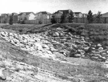
Between the foothills and Denver Clear Creek flows through the City of Wheat Ridge. In two separate locations the spring rains and steady high flows on the creek eroded the bank so much that the adjacent trail was undermined. Addressing these problems promptly was important in order to prevent further erosion and damage to public facilities. The City of Wheat Ridge participated in funding these repairs. This allowed us both to get more work done within our budget constraints. The solution was to rebuild the banks and armor them with riprap.
The high flows this spring also caused erosion on about 300 feet of Cherry Creek immediately upstream of its confluence with the South Platte River. Our solution was to install a low wall of boulders to stop the erosion. The boulder wall is consistent with improvements that have been made on several other parts of Cherry Creek. We were unable to get to the project immediately because relatively high flows on the creek continued well into the summer.
Two creeks in Boulder County were damaged by the spring rains. Five separate locations of the concrete access trail on Boulder Creek in Boulder were either undermined or buried by sediment. Repair of these sites involved using riprap and boulders to reinforce the creek bank. Severe damage occurred to the access trail along Coal Creek through the unincorporated portions of Boulder County near Louisville and Lafayette. This trail was originally constructed of compacted "crusher fines" and followed an alignment that, in some sections, was within a few feet of the creek bank. At those locations where the high runoff inundated the trail the water swept away all the aggregate. It was illuminating to recognize that the trail was the only item damaged as even the vegetation adjacent to the trail withstood the erosion.
In past issues of Flood Hazard News we reported that some of the concrete-lined channels in the Montbello area of northeast Denver had been damaged. Inadequate reinforcement, thin concrete sections, and lack of weep drains were blamed for the failures. This type of failure continued this year with the bottom and side panels being torn out of a forty foot long section. We installed a temporary repair of riprap and will soon construct a concrete channel for the full length of the 610 foot long block.
In an urban area a drainageway full of vegetation can present a dilemma to local jurisdictions. If the creek was originally confined by development there may be so little surplus flood-carrying capacity in the channel that there is no room for additional tree and shrub growth. As a drainage basin is developed base flows in the creek typically increase, resulting in expanding vegetation growth. While the vegetation is generally welcomed by all of us the additional vegetative growth directly reduces the flood carrying capacity of the creek. Removal of selected vegetation can become necessary in order to retain the flood capacity of the creek.
Since 1981 we have occasionally carried out tree-thinning operations on Cherry Creek
in Denver from University Boulevard to Iliff Avenue. In 1995 we again thinned the trees in
this reach of Cherry Creek. As in the past we conducted engineering studies to assess the
resistance to flow caused by the tree growth. We held meetings with the neighborhoods
along the creek and also consulted with wildlife specialists and the Denver Forester's
office. The result was a limited tree thinning operation during the late winter which is a
period of relative inactivity for animals and trees. We removed only that percentage of
trees that was necessary to return the necessary flood-carrying capacity to Cherry Creek.
Managing tree growth is a never ending activity so we anticipate doing this kind of work
on Cherry Creek on a regular basis.
Rehabilitation Maintenance
Twenty-eight projects were at various stages of design or construction during 1995. Those projects are listed in the accompanying table titled "STATUS OF MAINTENANCE REHABILITATION PROJECTS". By the end of 1995 the District will have spent about $827,000 on rehabilitative design and construction for the year. A few of the unique projects are discussed below.
As the activity at Stapleton Airport has diminished our project on Westerly Creek immediately south of the airport has changed. Our recommended solution to the collapsing 60" pipe is still to replace the pipe with an open channel. But, with closure of the airport, land use considerations are changing. This has delayed the acquisition of the necessary easements.
The design has just been completed for the rehabilitation of Airport Creek at 112th Avenue and Harlan Street in Westminster. A landscape architect is the prime consultant for this project to correct the localized aggradation and degradation. The wide drainageway corridor permitted the consultant to take advantage of the gently graded open space to design the drainage repairs and incorporate some aesthetic features.
The heavy spring runoff severely damaged a drop structure and about 100 feet of gabion bank protection on Lena Gulch. The site is downstream from the Consolidated Mutual water treatment plant at 27th Avenue in Lakewood. Repairing the damage is a top priority for the local governments in the area. Design is well underway with both the Maintenance Program and the Design and Construction Program of the District participating in the project. In order for the Maintenance Program to participate funds had to be re-prioritized from a bank stabilization project proposed for Lena Gulch just downstream of the damaged drop structure. The bank stabilization has been re-scheduled to 1996.
 |
 |
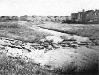
A portion of the Clear Creek trail before and after repairs.
|
Low flow channel repairs on Cherry Creek near the confluence.
![]()
The Design and Construction Program is participating in construction of improvements on Goldsmith Gulch at Yale Avenue and also at Dartmouth Avenue. Between those two streets is Bible Park. Within Bible Park the low flow channel for Goldsmith Gulch has eroded into a vertical-sided channel ranging from three to ten feet deep. The Maintenance Program will rehabilitate the eroded channel. In addition to repair to the channel the opportunity exists for park-related aesthetic and habitat improvements. Denver Parks Department, neighborhood representatives, design consultants, and Maintenance Program staff have begun a series of meetings and working sessions that will produce the desired concept for improvements to the Goldsmith Gulch channel and adjacent park land.
Another section of Cherry Creek has been improved with boulder edging of the low flow channel. The District funded the boulder edging work as part of the Greenway Foundation's project to build a series of temporary boating pools in the creek. The project is located between Delgany Street and Market Street and included a new access ramp into Cherry Creek.
Four years ago the Maintenance Program repaired a portion of Lakewood Gulch on the east side of Federal Boulevard in Denver. It consisted of short vertical structural walls to control the erosion. The section to be rehabilitated now is to the west of Federal Boulevard. The design of this section has been a process of evaluating the severity of the damage and assessing the appropriate repairs. The process has resulted in a design that is less structural than shown in the original concept and a design that is far less structural than the project east of Federal Boulevard.
![]()
 MOUSE MAY IMPACT PROJECTS
 by: Mary L. Powell, Environmental Specialist MDG &
Associates, Inc.
The Preble's meadow jumping mouse (Zapus hudsonius preblei) is a small, long-tailed mouse with hind legs much longer than its forelegs. It occurs mostly in low undergrowth with grasses or other nonwoody plants, or both. It can also be found in open, wet meadows and riparian corridors near forests or where tall shrubs and low trees provide adequate cover.
The U. S. Fish and Wildlife Service (USFWS) has initiated the process required to list the Preble's meadow jumping mouse as threatened or endangered under the Endangered Species Act (ESA). If the species is listed as threatened or endangered all federal agencies must ensure that actions which they fund, approve, or carry out do not "jeopardize" the species or adversely affect its designated critical habitat. Additionally, all persons, public or private, must comply with the prohibitions of the ESA, including the prohibition of "take" of listed fish and wildlife species.
The Urban Drainage and Flood Control District must apply for 404 Permits from the U. S. Army Corps of Engineers for most of its projects. If the mouse is listed as threatened or endangered, the District will be required by the Corps to determine the presence or absence of the mouse before beginning work on those projects.
MDG & Associates (one of the District's revegetation and ecological consultants) has compiled the following list of questions and answers regarding the ESA listing process and possible consequences.
What are the steps required to actually list the mouse? There are four steps:
1. Petition for listing - On August 16, 1994, the USFWS received a petition from the Biodiversity Legal Foundation to list the mouse as threatened or endangered. Such a petition must support its claim with credible data and research. The USFWS has up to 90 days to accept the petition.
2. 12-month finding - The USFWS has one year to review the accepted petition for listing of the mouse. After this review a 12-month finding is published. The 12 month finding will provide a summary of research on the known populations of the mouse, on mouse habitat, and on historic and current threats to the mouse and its habitat.
3. Public comment period - Following the publication of the 12 month finding, there will be a 60 day period for public comment on the listing of the mouse. If requested, a public hearing must be held within 45 days.
4. Final Determination - The USFWS has one year from the publication of the 12 month finding to determine the final status of the mouse. The USFWS will recommend listing the mouse if it finds that mouse populations are in danger of precipitous declines and that no local, state, or federal actions are being taken to conserve the mouse.
Where are they in the listing process? Currently, the USFWS is planning to publish the 12-month finding prior to the end of 1995.
How likely is it that the mouse will be listed? And when? Very likely.
Late 1996 or early 1997.
How much of the District's jurisdiction is possible mouse habitat? Based on current information, most of the areas under District jurisdiction will not prove to be appropriate mouse habitat. When applicable, a letter from a certified mouse habitat surveyor excluding the site from survey requirements will probably satisfy ESA requirements, including 404 permit requirements.
Is there a minimum size of habitat required to support the mouse? It depends on the quality of the habitat. Typically, the mouse has a home range of between 1/2 and 1 acre.
Will the mouse recolonize disturbed areas? It depends on the habitat present before the disturbance, on the habitat that exists following the disturbance, and the presence of a source of recolonizing mice. If the site was previously mouse habitat and disturbance is low to moderate, recolonization is possible if mice can move back into the site. If the site has been greatly modified, such as complete regrading of a site, recolonization is very unlikely.
Do mowing activities affect the mouse, and are mowing activities covered by the Endangered Species Act? If the area has not been mowed in the past and is mouse habitat, it is likely that the mouse would be affected. If the mowing has been on-going for some time, that activity will not be a problem (no mice). Mowing is covered under the Act if it modifies critical habitat to the exclusion of mouse use.
Are sedimentation removal projects going to require a survey? What about disturbance from access to the site? Sedimentation removal projects will probably not require a survey. Unless the disturbance from construction access is permanent, that is probably not a problem either.
If the mouse is listed, will on-going projects be affected if they already have 404 permits? Yes. Projects will still require a finding of "No Jeopardy" if they are in potential mouse habitat.
Are there any habitats exempt from the survey? Yes, riprap, heavily overgrazed areas, historically mowed areas, landscaped and maintained lawns, monocultures of cattails, and areas continually inundated by standing water are exempt. Additionally, the USFWS has not included the City and County of Denver in its survey requirements although some areas in Denver have been identified as medium to high priority as potential habitat (i.e. Bear Creek).
What does a survey for the mouse involve? The surveys for the mouse must be done when the mouse is most active - nights from May 31 to September 15. A survey involves setting traps over the course of four nights. Each survey site must have a total of at least 400 trap-nights (e.g. 100 traps each night for four nights). A team of at least two qualified surveyors must check the traps several times during each night. For each small mammal trapped, information must be collected on species, length, weight, sex, and age. If a Preble's mouse is trapped it must be photographed and hairs must be collected for genetic analysis. The survey report includes detailed descriptions of the site including soils, hydrology, vegetation, and geomorphology.
What are possible consequences to the District? The results of listing the mouse are uncertain. It is very likely that the US Army Corps of Engineers will require addressing the mouse in its permitting process. If the mouse is found at a project site, the USFWS must be consulted to determine reasonable and prudent alternatives that may involve any of the following: 1) move the project location 2) change the timing of the project 3) reduce the project size 4) modify the project scope 5) provide additional protection and /or habitat for a listed species.
![]()
Grouted Sloping Boulder Drop Structures - A Success Story
by Bill DeGroot, P.E. Chief, Floodplain Management
Program
In 1985, the District retained the firm of McLaughlin Water Engineers, Ltd. to assist in a major revision of the "Structures" chapter of Volume 2 of the Urban Storm Drainage Criteria Manual. Our focus was on improving the variety and design guideance for drop structures used in the commonly encountered urban drainage situations. The effort was completed under the direction of Bill Taggart.
A thorough literature review was conducted; as was an evaluation of many drop structures which had already been constructed in the Denver area, and which could give some real life experience to the study effort. The information garnered in these investigations was utilized to assist in the completion of a significant amount of computer modeling and other design efforts to arrive at four drop structure designs which were included in the revised "Structures" chapter.
In the years since distribution of the revised chapter, one of the four drop structures, the grouted sloping boulder (GSB) drop structure, has become the overwhelming favorite of both local governments and private developers. Its versatility and aesthetic features have made it the favorite. This photo essay demonstrates several of the different applications for this design.
![]()
 The GSB can be used for almost any practical drop height, in this case a 20 foot high drop on SJCD (South) in Littleton. |
 The GSB has the versatility to "hook on" to an existing structure to extend its vertical distance, here on Cherry Creek. |
 The GSB can be used for low flow checks, as in this application on Cherry Creek. |
 In a drainageway with a base flow the GSB can be aesthetically pleasing as is this one near Cherry Creek shopping center. |
 The GSB can be modified for special applications, in this case the Creekfront project on Cherry Creek in downtown Denver. These two pictures are looking upstream and looking downstream. |
  The Maintenance Program uses the GSB for new and replacement drop structures on Cherry Creek downstream from the dam. |
  Developers also favor the GSB. These structures are in the Stonegate area in Douglas County. |
![]()
Design and Construction Notes
By: David W. Lloyd, P.E. Chief, Design and Construction Program
STATUS OF DISTRICT DESIGN PROJECTS
| Project | Participating Jurisdiction(s) | Status |
| Dutch Creek | Columbine Valley | Complete |
| Ralston/Leyden Feasibility | Arvada, Corps of Engineers | On hold |
| Van Bibber Final Design | Arvada, Corps of Engineers | On hold |
| Eastlake No. 3 | Thornton | Prelim. Complete |
| Clear Creek @ 52nd Ave. | Denver | Complete |
| Cherry Creek Drop @ Iliff | Arapahoe County | 5% Complete |
| Lakewood Gulch | Denver | Prelim. Complete |
| Lena Gulch Schd. V | Wheat Ridge | Complete |
| Toll Gate Creek Drops | Aurora | Complete |
| Lone Tree Creek Detention | Arapahoe County | 95% Complete |
| Weaver Creek at Simms | Jefferson County | 50% Complete |
| Pleasant View Trib. to Lena | Jefferson County | 25% Complete |
STATUS OF DISTRICT CONSTRUCTION PROJECTS
| Project | Jurisdiction(s) | Cost | Status |
| Goldsmith Gulch Phases 1, 2, 3 | Denver | $10,100,000 | 60% Complete |
| Granby/Sable | Aurora | 752,000 | 40% Complete |
| Chateaux Beaumar | Littleton | 350,000 | 90% Complete |
| I-25/46th & Pecos | Denver | 600,000 | 5% Complete |
| Drainageway F | Arapahoe County, Littleton | 70,000 | Complete |
| University/Mexico | Denver | 800,000 | Complete |
| Irondale 80th Ave. Detention | Adams County | 655,000 | 20% Complete |
| Goose Creek | Boulder | 3,300,000 | Complete |
| Gregory Canyon Cr. | Boulder | 300,000 | Complete |
| Knox Outfall | Arapahoe County | 559,000 | 95% Complete |
| Lower Ralston Cr. | Arvada | 2,670,000 | 40% Complete |
| 17th & Ulster Ph. III | Denver | 450,000 | Complete |
| Mushroom Farm Detention | Westminster | 450,000 | 95% Complete |
| Valverde Outfall | Denver | 475,000 | 10% Complete |
| Sand Creek Buckley to Colfax | Aurora | 1,230,000 | Complete |
| Slaughterhouse Gulch Ph. IV | Arapahoe County | 1,240,000 | Complete |
| Lena Gulch - Lewis Meadows | Wheat Ridge | 70,000 | Complete |
| Bear Canyon Cr. - Martin to Moorhead | Boulder | 1,200,000 | Complete |
| Bear Canyon Cr. - Mohawk | Boulder | 400,000 | 15% Complete |
| Dry Gulch - 15th/Kipling Detention | Lakewood | 1,600,000 | 30% Complete |
| Dry Gulch at Colfax | Lakewood | 150,000 | Complete |
1995 was another busy year for the design and construction program with over $7 million committed to design and construction projects by year end. Most of this funding has gone toward construction with several large projects either under way or completed this past year.
Three separate contracts totaling over $7 million are now underway on the Lower Goldsmith Gulch Project. The first and largest of the three contracts began construction in February of this year, a second in September and the third will get underway this month. All three contracts should be complete by July, 1996. Once construction is complete, the flood control project will remove approximately 100 homes and 13 businesses from the 100-year flood plain as well as provide relief from frequent street flooding in the basin. This has been a joint project with the City and County of Denver through its Wastewater Management Division and culminates many years of work by the local sponsors, their consultants and the local citizen groups.
The second phase of construction for the Goose Creek Channel Improvement Project was completed this past year in the City of Boulder. This phase of construction along Goose Creek between Foothills Parkway and 30th Street was accomplished through three separate construction contracts over a period of two years. Total cost of the improvements was approximately $3.3 million. The third phase of improvements will begin design in 1996 with construction to occur hopefully in 1998. This third and final phase will extend from 30th Street to west of 28th Street.
The District is currently cooperating with the City of Arvada in the construction of channel improvements to the lower reaches of Ralston Creek as part of the City's Ralston Road Extension Project. Part of this project involved the purchase of a mobile home park at the confluence of Ralston Creek and Clear Creek. This park of approximately 90 homes has had a long history of frequent flooding from Ralston Creek. The City of Arvada is to be complemented in their tireless efforts to pull together a funding package for the purchase of this property. It is interesting to note that the City intends to develop the property into a park which will center around the theme of Colorado's gold discovery days. It is thought that the area along the lower reaches of Ralston Creek is where gold was first discovered in Colorado.
Another project which has some Colorado historical significance is the stormwater detention project at 15th Place and Kipling on Dry Gulch in Lakewood. This project started construction in late fall of this year and will detain flows from the highly developed area to the west including the Westland Shopping Center and other commercial areas along West Colfax. The District has cooperated with the City of Lakewood in the purchase of what is known as the Howell Homestead, an 11 acre site thought to be the first homestead in what is now the City of Lakewood. The home that is currently on the site was built in 1876 by Cason Howell, one of the first settlers of central Lakewood. It is interesting to note that Kipling Street was originally called Howell Road. The project preserves the homestead on its 1.1 acres of land and utilitizes the balance of the property for detention storage along Dry Gulch which flows along the south edge of the property.
![]()
Finally! Ground breaking ceremony at Goldsmith Gulch. |
  The Goldsmith Gulch project includes grass-lined channels and double box culverts as well as both on-line and off-line detention facilities. |
 A small flood event on Bear Canyon Creek in Boulder. |
|
 Goose Creek, looking upstream toward 30th Street in Boulder, prior to revegetation. |
|
![]()
Floodplain Management Program Notes
by Bill DeGroot, P.E. Chief, Floodplain Management
Program
New Development Continues
This has been another very busy year for the floodplain management program. The development boom continued in 1995. I don't try to keep track of the total number of referals we review annually, but I know 1995 was one of the busiest ever.
The District's maintenance eligibility program once again processed a large number of
projects constructed by developers. We reviewed 267 projects for some aspect of
maintenance eligibility, most of them on more than one occasion. Boyle Engineering
Corporation has observed construction for us again in 1995, and makes recommendations
regarding acceptance of constructed projects for District maintenance eligibility. We
expect to close out approximately 50 projects this year. Boyle currently has 41 sites
under observation with more projects in the pipeline and more proposals coming in the door
every day.
NAFSMA
I was recently appointed chair of the FEMA Relations Committee of the National Association of Flood and Stormwater Management Agencies (NAFSMA). Since NAFSMA has been concentrating on the quality side of things for the last few years, one of my first responsibilities was to prepare an agenda of FEMA related program improvements that NAFSMA can pursue on a proactive basis.
A long list of potential items was discussed by the committee at NAFSMA's annual
meeting in Washington in November. A draft agenda resulting from that discussion is now
being circulated for comment. I expect to have a final agenda soon after the NAFSMA board
meets in January.
Community Rating System
The Community Rating System (CRS) still appears to me to be more trouble than it's
worth for most communities. I particularly dislike the huge amount of paperwork involved
and, even worse, the way in which FEMA investigates the CRS applications of the local
governments; which I think demonstrates that FEMA does not trust the local governments to
fill out the forms truthfully. For example, we were sending annual notices of flood
hazards to all addresses in identified floodplains for several years before anyone ever
thought of the CRS. Local governments have tried to gain a few points because we do this.
However, every year we go through this investigation as though this is something
completely new which must be thoroughly scrutinized, lest a local government get a few
undeserved points and squeak into a CRS rating of 8.
Things That Drive You Crazy
I recently reviewed a sketch plan for a proposed residential subdivision which had a 100-year floodplain depicted on it which was labeled: "Calculated 100 year floodplain. Not FEMA designated." The sketch plan also contained this note: "According to the . . . County Map of Environmental Constraints and Hazards, there are no flood hazards on the site."
Am I the only one who is bothered by this? The engineer has investigated the site and
has identified a flood hazard. What does it matter that FEMA hasn't designated it and/or
the local government hasn't mapped it?
More CRS
According to a recent report from the Association of State Floodplain Managers the Corps of Engineers and both houses of Congress are apparently giving serious consideration to a proposal to develop a sliding cost-share formula for Corps civil works projects based on the quality of the applicable state and local floodplain management programs. Basically, the better the programs are, the larger the federal cost share becomes. That concept sounds pretty good to me. However, one proposal would use the CRS rating to determine the effectiveness of local programs, which I think would be a huge mistake.
Without spending hours and hours of time filling out pages and pages of forms so that federal investigators can come snooping around to see if I told the truth, I think I can accurately state that we have an excellent floodplain management effort going on in the Denver metropolitan area. During the last 20 years our population has increased by approximately 750,000 people. With all those new people came thousands of new structures to live in and work in, and yet you can count the number of new structures built in identified floodplains on one hand. Also during the last 20 years the District and local governments have spent in excess of $125 million on drainage and flood control projects which have removed several thousand existing structures from identified floodplains.
We have been mailing annual notices of flood hazards to every address in every identified 100-year floodplain since 1975. We have a flood warning effort that includes 24-hour coverage by private meteorologists, acquisition of NEXRAD radar images and satellite photos, 130 alert stations gathering rainfall, streamflow and other data, and daily forecasts provided to all local governments. We have a $4 million annual maintenance program. All our communities with identified flood hazards are in the NFIP and have the required floodplain management regulations in place.
While the flood risk to the nation as a whole continues to increase annually, the flood risk in the Denver area continues to go down. And yet, for some reason the best CRS rating any Denver area community had been able to obtain until recently was a 9, which is the default value given to any community which applies. Are the floodplain management efforts of Denver area communities flawed or is FEMA's CRS program flawed? I submit that we have done a hell of a job over the last 20 years and that FEMA's attempt to measure success is terribly flawed. It would be a mistake for the Corps or the Congress to use this flawed measuring device to determine who is doing a good job and who is not.
![]()
Chevron Gas Station Site Restoration
by: Ben Urbonas, P.E. Chief, Master Planning and South
Platte River Programs
In 1993, the District and Denver Wastewater Management Division entered into an agreement to purchase a gasoline station site owned by Chevron, Inc. The building and the underground gasoline tanks on the site had already been removed when Chevron put it on the market. Bill DeGroot noticed the For Sale sign and advised me that the site was available for purchase. Since the acquisition of this site was recommended in the South Platte River Major Drainageway Plan, we moved aggressively to acquire it.
The site had been previously cleaned of all contaminants by Chevron and was informally given State approval, but concerns about the continuing site contamination liability delayed the actual closing date by over one year. Eventually a satisfactory agreement was reached between Denver and Chevron and the site was turned over to Denver in 1994.
The old gasoline station site was located along the east bank of the South Platte River immediately north of Eighth Avenue. It had old steel pipe ballards and cable to keep vehicles out (most of the cables were cut and ineffective), the river bank was nearly vertical and the south end of the site had an 18 foot tall vertical retaining wall without any safety railings. As a result, we were concerned about safety now that the site was in public ownership. After discussions with Nick Skifalides, Deputy Manager of Public Works, Wastewater Management Division, resources were committed to restore the site to a more natural state and to improve its appearance and safety.
The three accompanying photographs show some of the results of this effort. More specifically it included the following:
| The oversteepened river banks were laid back (without the removal of a single tree) | |
| All pavement was removed and disposed of | |
| The southeast corner of the site was raised using modular block wall to keep vehicles out | |
| Wood 6"�6" ballards were installed at 5' centers to control vehicle access along the remaining perimeter | |
| The entire site was covered with topsoil and revegetated | |
| Denver Parks Department donated trees which were planted by volunteers during National Trails Day | |
| The newly planted trees were watered all summer by inner city youth hired by the Greenway Foundation under a contract with Denver. |
 Looking across Eighth Ave. at the site. Note the short retaining wall to keep cars off the site. |
|
 Eighteen foot high retaining wall before site restoration. |
 The site was opened up to the river by cutting back the retaining wall and adding railings,all without the loss of any trees. |
The cleanup and enhancements to this site could not have been done without the local partnerships that developed as this project progressed. Now that the initial work is done we will provide follow up maintenance to insure the establishment of a healthy native grass ground cover suitable for this semi-arid region since the site will not be watered. We expect grass cover to be fully established and noxious weeds to be under control within a three to five year period. After that, occasional site cleanup and maintenance should maintain this site as a "natural" green area adjacent to the South Platte River for local residents and visitors to see, enjoy and appreciate.
![]()
Spiranthes diluvialis Update
By Mike Sarmento, Engineering Inspector, Maintenance
Program
The District is required to conduct Spiranthes diluvialis (Ute ladies'-tresses Orchid) surveys for all drainageway projects within Jefferson and Boulder Counties, as well as for other projects within the 100-year floodplain of the South Platte River and its perennial tributaries, as one of the conditions for obtaining a Corps of Engineers' 404 permit. We have conducted over 200 such surveys during the last three and one-half years at an approximate total cost of $75,000. This cost does not include staff time for coordination with consultants, field meetings, letters, etc. To-date no orchids have been located from these surveys.
The District has been able to reduce the cost of many of these surveys by providing a site exclusion letter from a qualified Spiranthes surveyor A site exclusion letter is used when the site conditions obviously don't meet the criteria established by the US Fish & Wildlife Service. Such sites include silt removals from concrete trickle channels, severely eroded banks where there is no remaining native vegetation, etc. The average cost of a site exclusion letter was $350 - $400.
The year 1994 was our busiest year for conducting Spiranthes surveys. Approximately 70 sites were surveyed at a cost of $24,000.
According to the guidelines established by the US Fish & Wildlife Service Spiranthes surveys are only good for a three year period, so those surveys conducted in 1992 will expire as of this December 31st. The District may be required to redo these surveys as determined by USF&WS.
![]()
Portions of South Platte River Exempted from Spiranthes diluvialis Surveys
by Mary Powell, MDG Associates Bryan W. Kohlenberg,
P.E., UDFCD
The South Platte River Program has performed 24 Spiranthes diluvialis surveys at a total cost of $17,500. The surveys required at least a week or two to produce a report suitable for USFWS review and typically up to 45 days to receive a letter of concurrence from the USFWS. Not one of these surveys has revealed the presence of the orchid or its habitat along the South Platte River
In order to expedite the project 404 permit approval process, the District and MDG approached the USFWS with the idea of doing a blanket search for possible orchid habitat on the South Platte River from C-470 to the confluence with Sand Creek. After agreeing on appropriate survey methods and documentation, MDG assessed this river segment for orchid habitat suitability. It was determined that some possible habitat existed from C-470 north for about three miles. From this point to Sand Creek no suitable habitat was found. As a result, the USFWS granted the District a river reach exemption from additional orchid surveys along the South Platte River for all of Denver County and portions of Arapahoe and Adams County, covering 18.6 river miles.
This effort proved to be beneficial to all parties. The District can now obtain 404 permits for work on the South Platte in the exempted reach without needing individual orchid surveys for each project. The District will recover the cost of the blanket exemption survey on the first three projects and stands to gain significantly on remaining projects throughout the three year exemption period. Consequently, the USFWS benefits from the blanket exemption by receiving information about a significant portion of the South Platte River, thus saving services and administration time and cost. We also hope the information will be used by USFWS to more narrowly define the survey requirements along other urbanized streams, further reducing time and survey costs to the District and to others doing work along various waterways in this urban region.
![]()
FLOOD WARNING & PREPAREDNESS
Kevin G. Stewart, Project Engineer Floodplain Management
Program
Press Release Ready for Next Flood
Last year's Flood Hazard News reported that the District and the City of Arvada cooperated in publishing a Flood Protection Handbook and Post-Flood Recovery Assistance Plan. The project team focused primarily on Arvada's flood hazards and developed recommendations based on recent experiences of many disaster-stricken communities in other parts of the United States. While we believe this effort has better prepared Arvada and its residents for a large flood, the fact remains that Arvada with its estimated 1300 flood-prone properties has never experienced a flood "disaster." Consequently, it is difficult for many to perceive a flood problem or any personal risk.
The same may be said for most residents living in the Denver area with the 1976 Big Thompson flood approaching its 20th anniversary and fading from memory; with three large federal dams controlling floods on the South Platte River, Bear Creek and Cherry Creek making a repeat of the 1965 flood an "impossibility;" and with the District and its local government partners continuing to remedy many of the more troublesome drainage and flood problems. Given this complacency and knowing that floods remain the greatest potential hazard to people and property in Colorado, the District has taken one additional step to help citizens recover after a flood disaster by preparing a one page print-ready layout for local newspapers.
The press release was prepared by Jacquelyn Monday of Lakewood, Colorado, who also served as the technical editor for Arvada's Flood Protection Handbook. The "After-the-Flood" chapter of the handbook served as a guide for designing this page. This newspaper layout contains locally appropriate information advising homeowners and residents on what to do after being damaged by a flood. Only minor revisions like local contacts and phone numbers will be needed before releasing this information.
The District has incorporated procedures in its Flood Disaster Plan for issuing this
press release immediately after a flood has caused extensive property damage. We hope that
this page will never need to used but history teaches us that we should plan now for the
inescapable disaster. Local governments wanting information on how to develop their own
self-help programs may contact the District for assistance.
ALERT Rainfall Accuracy
In a recent ALERT Transmission newsletter, Dr. David C. Curtis, DC Consulting, Folsom, California, authored an excellent article discussing wind effects on rain gauge catch. Referencing available scientific literature, Dr. Curtis concluded that a reasonable undercatch estimate for unshielded ALERT tipping bucket rain gauges is one-percent per mile-per-hour of wind speed occurring at the height of the rain collector orifice for wind speeds of 30 mph or less. For higher wind velocities, the effects are more uncertain. Combine these uncertainties with the problem of obtaining real-time wind data at a ten-foot height at 113 gaging stations and we can safely conclude that wind-adjusted ALERT rainfall measurements will pose an interesting challenge for the future. Rain gauges can be shielded from wind to some extent but for standard 10-foot standpipe towers, constructing shields is not practical and aesthetically unacceptable in many cases. Trees and buildings may help reduce direct wind effects but may cause other problems which are even more difficult to quantify. In Oklahoma, mesh screens designed to minimize debris problems have been identified as an undercatch culprit by causing splash loss.
It is our opinion that ALERT rain gauges have to be well maintained and routinely tested in the field to give users confidence in the measurements they report. "Accuracy" is a relative term which all data users must understand. Providers of ALERT rain data should take time to educate data users concerning their definition for accurate and the various other data error possibilities. ALERT gauges can reliably measure heavy precipitation and give decision-makers early indications that critical rain thresholds are being exceeded. How accurate is this data? Probably accurate enough for flood detection purposes.
The District routinely attaches a written disclaimer in response to requests for ALERT
data.
Flood Threat `95
From May through July, many Coloradans were bracing for possibly the worst snowmelt runoff flooding in the past decade. The news media continuously reported information about this treat over the 3-month period. The state's first Flood Task Force, lead by Larry Lang of the Colorado Water Conservation Board (CWCB), held weekly meetings during May and June keeping the public well informed of flood potentials. The Jefferson County Department of Emergency Management formed a similar task force to address specific county concerns. The City of Boulder established two 24-hour telephone "hot lines" for the public to obtain general and emergency flood information. Many government agencies and volunteers joined with other public and private organizations in preparing for the worst. Fortunately, the worst did not occur.
After the spring floodwaters receded, CWCB and the Colorado Office of Emergency Management reported 15 flood-related deaths statewide and damage estimates approaching only $20 million. Most of this damage occurred outside the District. Agricultural land along the South Platte River in Weld and Logan counties, and 14 homes in Georgetown along Leavenworth Creek were identified as some of the areas hardest hit. Cool weather lasting until mid-June was credited for moderating the snowmelt across Colorado. Even with this help from mother nature, record water levels were reported in many reservoirs due to the large volume of runoff. This did not please many avid boaters, fishermen and beach enthusiasts wanting to return to Chatfield Reservoir and Bear Creek Lake for summer fun.
Bear Creek Lake, a federal flood control reservoir in Lakewood, set a new high water record of 5587.17 feet (MSL) on June 17. This elevation is 29 feet above the normal pool level and 6.2 feet above the previous record set on June 23, 1983. Bear Creek Dam was completed by the US Army Corps of Engineers in July of 1977. The Corps released a maximum outflow of 612 cfs on June 25.
Chatfield Reservoir, located on the South Platte River above Littleton, recorded its third highest water level since its completion in August of 1973. The lake level rose to an elevation of 5446.40 feet, peaking on July 4 just 1.18 feet lower than its May 26, 1980 record. A new record release of 3350 cfs was set this year on July 8. Chatfield Dam is also operated by the Corps of Engineers.
While the snowmelt flood threat received the greatest attention from the news media, peak streamflows at most locations in the District were caused by heavy rainfall, not melting snow. The heaviest measured rainfall was from a gauge operated by the Pinehurst Golf and Country Club where a reported 3.2 inches fell in less than one hour on the afternoon of Sunday, June 4. Pinehurst is located in extreme southwest Denver north of Marston Lake between Wadsworth and Sheridan Boulevards. Residential flooding and storm drainage problems were reported along a small south-bank tributary to Bear Creek just north of the golf course. The June 4 storm also caused flood problems in other parts of Denver, Englewood and Sheridan. This single thunderstorm produced the highest peak flows for the year along lower Bear Creek and the South Platte River through Denver. The following table summaries peak flows at selected stream gaging stations for this and other 1995 events:
1995 Peak Flows
| Location | Peak (cfs) | Date |
| Bear Creek at Morrison | 900 | June 18 |
| Bear Creek at Sheridan | 2,740 | June 4 |
| Cherry Creek at Steele St. | 1,100 | Aug. 18 |
| Clear Creek at Golden | 4,500 | June 19 |
| Goldsmith Gulch at Eastman | 900 | Aug. 18 |
| Ralston Creek at Carr St. | 1,470 | July 15 |
| Sand Creek at Brighton Blvd. | 1,400 | May 17 |
| S. Platte River at Dartmouth | 6,120 * | June 4 |
| S. Platte River at 19th St. | 10,800 | June 4 |
| S. Platte River at Henderson | 16,700 | May 17 |
* Errata December, 2000
The ALERT rain gauge network had only four locations which reported rainfall amounts exceeding 1-inch in less than an hour during 1995. These storms occurred on May 18, June 4, June 28 and July 15. An ALERT rain gauge in Arvada reported the heaviest amount of 1.61" in 25 minutes on July 15 at approximately 9:30 PM. This storm developed very rapidly near Standley Lake, moved slowly to the southeast, intensified over Arvada and forced closure of Colorado Highway 121 (Wadsworth Bypass) north of West 58th Avenue (Ralston Road). After causing Arvada and motorists some grief, the storm lost its energy and quickly dissipated, a very typical scenario for a late afternoon/early evening Front Range thunderstorm.
ALERT data is currently available from 130 gaging stations including: 113 rain gauges;
62 water level sensors located in streams, detention basins and reservoirs; and 8 weather
stations. Anyone interested in obtaining ALERT data from the District may contact Kevin
Stewart at (303) 455-6277 or fax your request to 455-7880.
Maintenance Costs Being Tracked
The maintenance program has compiled nine years of urban drainageway maintenance activities onto a single data base. These activities include all work conducted by the maintenance program from mowing and debris pickups to local erosion repair and major channel rehabilitation. The main categories of information in the data base are as follows:
As with all data base applications the information can be sorted in a variety of formats. Listed below are a few examples of the output available from the data base.
At the conclusion of each year's drainageway maintenance activities we will add the information for that year to the data base. As the period of time covered by the data base expands the output will become more representative of the cost of long-term drainageway maintenance.
Please feel free to call Mark Hunter at phone number 303-455-6277 or fax number
303-455-7880 if you would like to review the results from this data base. Questions
regarding specific drainageway configurations are welcome. The output from the data base
has not been integrated into a report so there is no document that can be distributed at
this time.
![]()
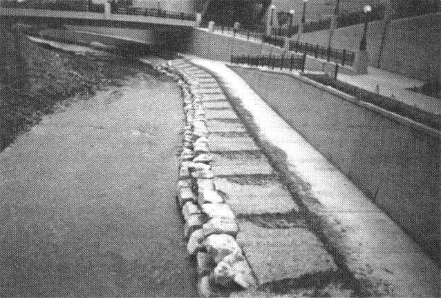