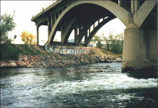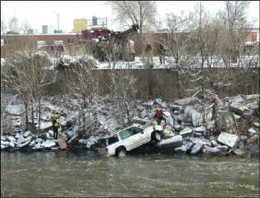
Photo 1: WHOOPS!!!
A Message from the Manager
The South Platte River Program is a unique program within the District that has
to address the needs of the largest receiving water (drainageway) within the
District. Its creation resulted in the master plan for the South Platte River
that was completed in 1985. One of the recommendations of this master plan was
that the District create a program and effort that had a focus on the mufti-use
and unique nature of the river.
In 1985, the District requested the State legislature to authorize a separate tax levy to maintain, reclaim and improve the South Platte River. The State agreed and the program was created in 1985.
In 1986 the District's Board of Directors adopted a resolution outlining the District's policies that spelled out how this program will operate. The Board recognized at that time the regional nature of the river. Namely, it said that this river corridor carries flood waters, provides aquatic and terrestrial habitat, acts as a recreational corridor, is the source of water for agricultural, industrial and municipal uses, and is the recipient of treated wastewater effluent and stormwater runoff from the entire metropolitan area.
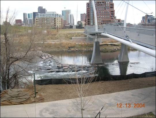
Since the program's inception I had the honor to steer it and to help shape many of the river restoration and enhancement activities. It has been a very rewarding experience. During that time the District participated with Denver to rebuild Confluence Park and to build many of the other related enhancements in the Central Platte reaches of the river. We also continue to work with Denver on significant river and environmental improvement projects along the I-25 through Eighth Avenue reach and in the Globeville reaches in north Denver.
We also worked with Adams County and the cities north of Denver to restore many miles of degraded river and eroded and trashed out riverbanks. In the process we installed a number of grade control structures that, for the most part, arrested the degradation of the river's thalweg and reduced the erosion of the banks. The results included significant improvements in river corridor aesthetics and in enhancements to the wildlife terrestrial and aquatic habitats along those reaches.
South of Denver we assisted the State of Colorado and the South Suburban Parks and Recreation District to maintain the corridor reaches the U.S. Corps of Engineers reconfigured as part of the Chatfield project. One of the more significant improvements was the installation of a utility buttress just downstream of C-470 to prevent the failure of a major water line and a sewer line. This grade control structure arrested the degradation of the riverbed while providing enhanced fish habitat, safe boater passage and fish migration rapids.
Finally, in 2002, in partnership with Adams County, the Cities of Commerce City, Thornton and Brighton, the Denver Water Department, South Adams County Water and Sanitation District and the Metro Wastewater Reclamation District we published the updated master plan for the river in Adams County. I want to thank these partners and also thank the local Corps of Engineers and EPA offices and the Colorado Division of Wildlife for the support, input and the hard work and dedication that it took to complete the updated plan.
The 2002 update expanded the focus along many of the river's reaches in Adams County, on floodplain preservation and acquisition, on continuing improvements to its aquatic and wildlife habitat resources and on the completion of the recreational tail. The goal is to have a continuous trail along the river from Chatfield Reservoir to the Adams-Weld County line that has no at-grade street crossings. In planning for the trail in Adams County, it was routed to avoid the most sensitive wildlife habitat areas. As a result, part of the trail will not be adjacent to the river.
The projects that I described above represent only a part of what we, along with our local government partners and with the cooperation of the U.S. Army Corps of Engineers, accomplished since 1986. I am proud of what the progress that has been made and look forward towards much greater accomplishments in the future.
However, it is time for me now to pass the day-to-day management of this most productive program to Bryan Kohlenberg. Starting in 2005 he will be reporting directly to David Lloyd in the position of a Senior Project Engineer with the District. I will continue to manage the Globeville capital improvement project, since the institutional memory for this very complicated project resides with me.
As I approach my retirement, something that I expect to occur within the next two to five years, I will focus on the Master Planning Program and the needed updates and enhancements to the District's Urban Storm Drainage Criteria Manuals, software, and implementations details. It has been a great honor and joy to lead this program and I thank everyone from the bottom of my heart that has helped us to implement the many improvements that have occurred since 1986 along the River.
Globeville Phase 3 Project
The final phase of Denver's
project to remove approximately 200 acres of highly urbanized lands in north
Denver from the 100-year floodplain is well under way, Denver is expecting to
initiative the bidding process for this multi-million dollar project early in
2005. The issues surrounding the railroad and the diversion system for FRICO, as
described in the last issue, appear to have been resolved and are close to final
agreements.
To further assist with this project, the District added another $950,000 of its funds in 2004 to this project's trust account. We now hope to see the construction on this project begin in 2005 and be completed in 2007.
Floodplain
Acquisition
The District continues to look for opportunities to partner with
Adams County and other jurisdictions to acquire lands within the South Platte
River floodplain. Now that Adams County has an open space acquisition program,
we hope to partner with them more in the future to acquire and preserve riparian
and other habitats along the river.
Zuni/Sun Valley Reach Project
Last year the
U. S. Army Corps of Engineers was able to pull enough funding together to move
the final design of the environmental enhancement project, along the Zuni/Sun
Valley reach of the Upper Central Platte River, forward to a 50% complete level.
Unfortunately, from this point forward additional funding is in jeopardy due to
the failure of Congress to enact the Water Resources Development Act (WRDA),
which reaffirms the federal governments pledge to authorize, modify and improve
projects, programs and policies protecting the nation from floods and keeping
our waterways navigable. Without final congressional action, no new water
resources development activity will be authorized to fulfill these important
missions and ongoing projects will come to a halt.
Once again, we are hopeful that Congress will appropriate the $15,000,000 to $18,000,000 needed for the construction of this project in their 2006 budget. Regardless of the budgetary outcome, the District and Denver are committed to implementing this project and are continuing to acquire the needed lands.
|
|
Routine Maintenance
In 2004, South Platte River
routine maintenance efforts included:
Colorado Total Maintenance, Inc. was re-contracted to perform these services in 2004. Over 200 truckloads of trash and debris were removed from the river and taken to landfills by CTM.
This year we have spent considerable time and effort to convert our South Platte River corridor aerial photos to a Geographic Information System (GIS) format. In order to accomplish this, we are utilizing ArcMap by ESRI. This change to a GIS format will allow us to widely distribute the routine maintenance contract documents to our local governments and others in a more efficient manner and at a reduced cost. It also allows us greater flexibility with respect to future modifications and updates to these documents. In the future, we plan to incorporate GIS into our Routine and Restoration Maintenance project management. Ultimately, we hope to have these documents accessible to the public through our web page.
For the seventh consecutive year we participated in the Greenway Foundation's annual NIMBY ("Not In My Back Yard") Fest volunteer trash pickup, during which an additional 50 cubic yards of trash were removed. In addition, government personnel and volunteer groups have picked-up and removed trash from the river corridor throughout the year. Trash is also regularly removed from trash receptacles that are maintained by park personnel along all recreational trails.
Routine Maintenance continues to be the most cost effective program in terms of environmental enhancement and public service. Without it, the trash along and in the river would accumulate tremendously, decreasing the enjoyment of the public as well as creating safety and sanitation issues. The routine maintenance program now completes more than twice the number of trash pickups and trail mowings along the South Platte River than we did 16 years ago. This has enhanced the environment along the river and helped increase public use of this unique corridor.
Noxious Weed Management
We continue to be aggressive in controlling
the many varieties of invasive vegetation that have taken hold along the river.
Working closely with Adams County, the City and County of Denver, the City of
Sheridan, and the South Suburban Parks and Recreation District, we have removed
Tamarisk (a.k.a. salt cedar), Russian Olive and a variety of noxious weeds
through cutting, and selective and careful application of herbicides, when
needed. This is followed by the plantings of native Plains Cottonwood, Willow
and various native dry land grasses.
Elimination of Tamarisk has become a high priority for not only Colorado, but for the entire western United States. Tamarisk is a highly invasive species that is well adapted to the climactic conditions of the western United States. Tamarisk thrives along waterways but is also adapted to drier conditions due to its deep roots. Due to the drought conditions experienced in the west, water consumption has become a major issue. A mature Tamarisk can consume up to 200 gallons of water, per day. Tamarisk tends to develop into thick, monotypic stands. Due to the plants' secretion of salts, and the deposition of salty plant litter, the surrounding soil conditions change to a saline environment over time. This change in soil conditions kills existing native vegetation and severely restricts any future native plant growth. Over time this is the method by which Tamarisk develops a monotypic environment. Tamarisk control and site reclamation is much easier if control measures are started early, before thick growth develops.
During 2004, the South Platte River Program began working with the Northeast Colorado Tamarisk Task Force (NoCoTTF). This task force is a coalition of various government agencies and private businesses. Their goal is to educate the public regarding the negative impacts of Tamarisk. Through these efforts, the task force hopes to eliminate Tamarisk in northeastern Colorado. According to NoCoTTF members, it is apparent that the Tamarisk control efforts of the District have greatly reduced the impact of Tamarisk along the South Platte River. These efforts began approximately 10 years ago and have been very successful in limiting the spread of Tamarisk along the river.
Tamarisk control will continue to be a necessity along the South Platte River even though it is in much better shape than many other watersheds in Colorado. For more information about the NoCoTTF or Tamarisk control measures, contact Kelly Uhing, Adams County Weed Specialist, at (303) 637-8115 or KUhing@co.adams.co.us.
|
|
|
|
Restoration Maintenance
In 2004, the following restoration maintenance projects
were completed:
Finally we have some good news for the wooden pedestrian bridge replacement near First Avenue (extended) in Denver. Design modifications have been made to deal with the adverse environmental conditions found at the site. Reconstruction of an approach ramp was added to comply with ADA requirements. Tierdael Construction Company is now underway with construction and should be completed with the bridge replacement in 2005.
In 2005 we expect the program to include the following restoration maintenance projects:
Cooperative projects are constructed on flowage and maintenance access easements dedicated to the District by private property owners adjacent to the river in exchange for river restoration work. This year we obtained an additional 19 acres of easement area. To date over 660 acres of such easements have been dedicated, resulting in over 29 bank stabilization and/or river grade controls and riparian revegetation projects since 1988. Several of these easements now contain the river recreation trail, which doubles as river maintenance access.
Two new cooperative projects were completed this year. At 120th Avenue in Adams County, Left Hand Excavating constructed 1,200 feet of soil riprap bank rehabilitation and stabilization along the river's east bank in cooperation with the Asphalt Specialties Company. Next year we hope to extend this project another 600 feet downstream to the future confluence with Henderson Creek. The second bank stabilization cooperative project was constructed by L & M Enterprises, Inc. along the river's west bank, just upstream of 104th Avenue. Here, approximately 1200 feet of soil riprap bank rehabilitation and stabilization was constructed on an easement dedicated by Aggregate Industries, Inc. Construction of a 1000 feet upstream extension of this project is currently underway.
Next year we hope to complete a previously delayed bank rehabilitation and stabilization project along the west bank of the river at the McIntosh Farm Company property in Adams County. Left unstabilized, this bank will ultimately degrade to the point where it will disrupt dairy farm operations that have been in place for over 100 years. In 2003, the farm company dedicated 31 acres of riparian area in order to get District assistance along their property.
We also hope to initiate construction of restoration improvements to the east bank just downstream of 104th Avenue adjacent to property currently owned, and to be mined, by Aggregate Industries, Inc.